
T53A Wise, VA, USA - Earthquake Result Viewer
| ||||||||||||||||||
| ||||||||||||||||||
| ||||||||||||||||||
|
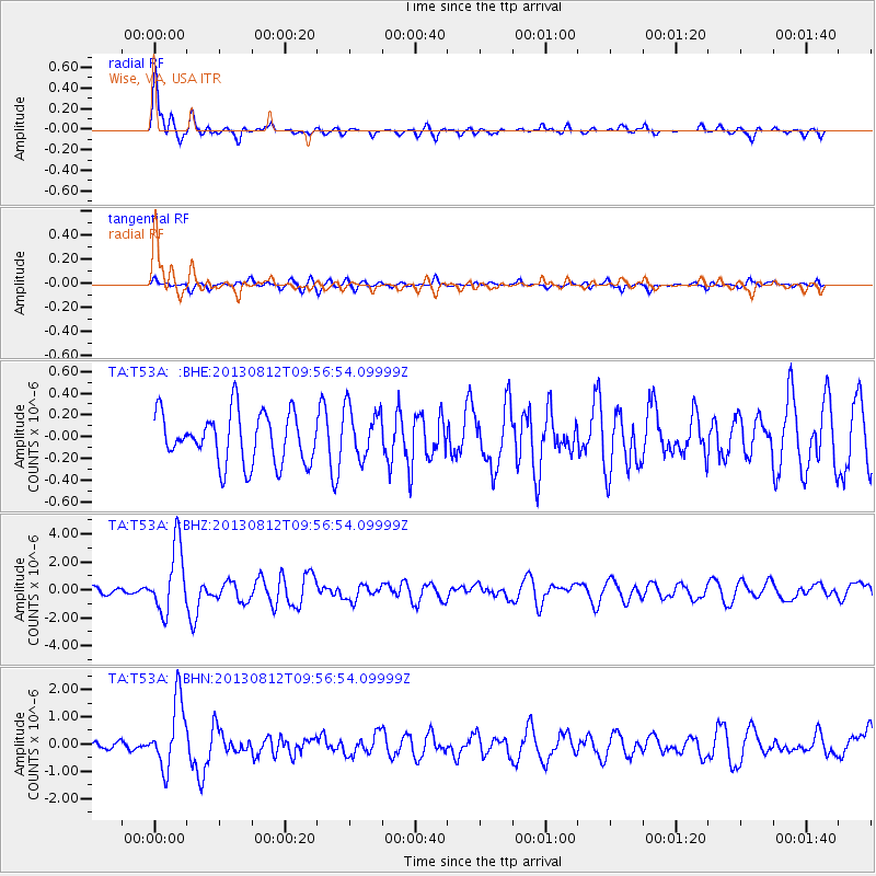
Signal To Noise
| Channel | StoN | STA | LTA |
| TA:T53A: :BHZ:20130812T09:56:54.09999Z | 9.724001 | 2.3859577E-6 | 2.453679E-7 |
| TA:T53A: :BHN:20130812T09:56:54.09999Z | 7.6821384 | 1.233281E-6 | 1.6053876E-7 |
| TA:T53A: :BHE:20130812T09:56:54.09999Z | 1.0417523 | 2.3921228E-7 | 2.2962492E-7 |
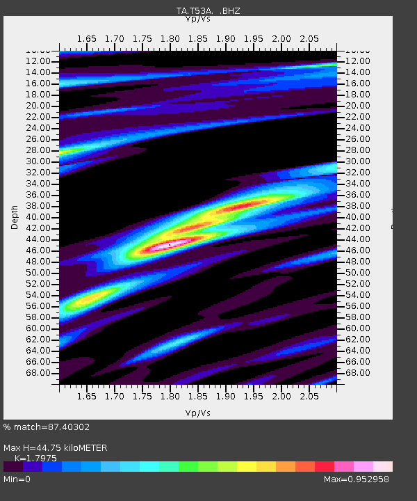
| Arrivals | |
| Ps | 5.9 SECOND |
| PpPs | 18 SECOND |
| PsPs/PpSs | 24 SECOND |

