T54A Tazewell, VA, USA - Earthquake Result Viewer
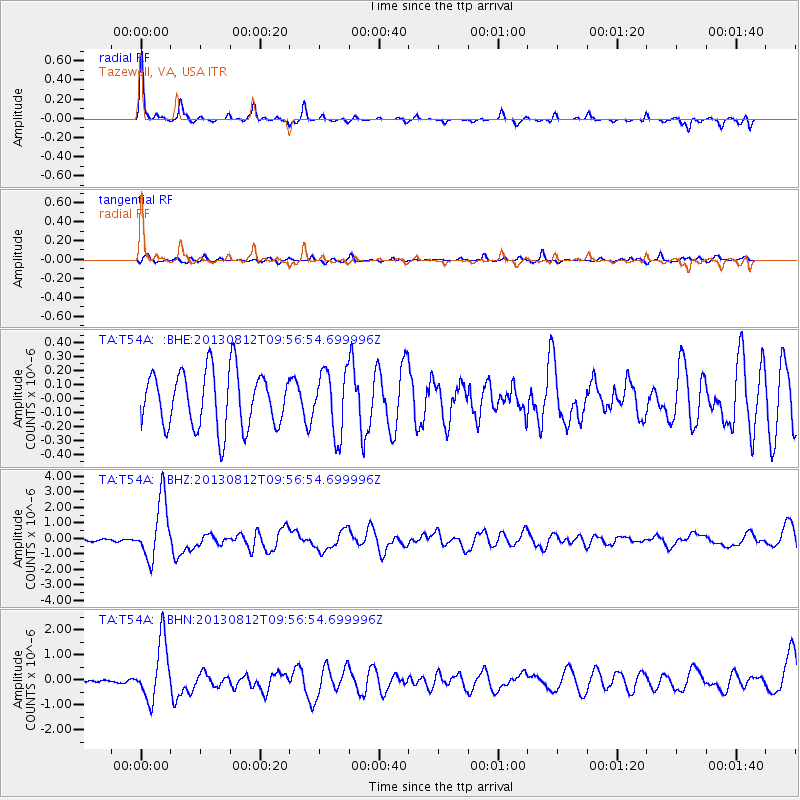
Earthquake location: Near Coast Of Northern Peru
Earthquake latitude/longitude: -5.4/-81.9
Earthquake time(UTC): 2013/08/12 (224) 09:49:32 GMT
Earthquake Depth: 10 km
Earthquake Magnitude: 6.2 MWW, 6.1 MWB, 6.2 MWW, 6.2 MWC, 6.3 MWC
Earthquake Catalog/Contributor: NEIC PDE/NEIC COMCAT
Network: TA USArray Transportable Network (new EarthScope stations)
Station: T54A Tazewell, VA, USA
Lat/Lon: 37.06 N/81.58 W
Elevation: 852 m
Distance: 42.2 deg
Az: 0.417 deg
Baz: 180.519 deg
Ray Param: 0.07328999
Estimated Moho Depth: 42.5 km
Estimated Crust Vp/Vs: 1.92
Assumed Crust Vp: 6.159 km/s
Estimated Crust Vs: 3.199 km/s
Estimated Crust Poisson's Ratio: 0.32
Radial Match: 80.10659 %
Radial Bump: 228
Transverse Match: 57.02618 %
Transverse Bump: 400
SOD ConfigId: 626651
Insert Time: 2014-04-17 23:34:51.764 +0000
GWidth: 2.5
Max Bumps: 400
Tol: 0.001

Signal To Noise

ChannelStoNSTALTA
TA:T54A: :BHZ:20130812T09:56:54.699996Z8.71711.8991959E-62.1787015E-7
TA:T54A: :BHN:20130812T09:56:54.699996Z4.17694851.1720924E-62.8060975E-7
TA:T54A: :BHE:20130812T09:56:54.699996Z1.1125032.2442998E-72.0173427E-7
Arrivals
Ps6.8 SECOND
PpPs19 SECOND
PsPs/PpSs26 SECOND