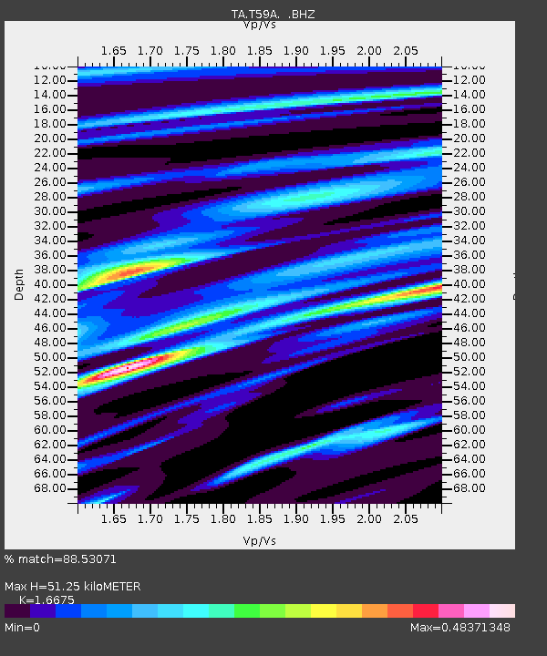
T59A Double 'B' Farms, VA, USA - Earthquake Result Viewer

Earthquake location: Near Coast Of Northern Peru
Earthquake latitude/longitude: -5.4/-81.9
Earthquake time(UTC): 2013/08/12 (224) 09:49:32 GMT
Earthquake Depth: 10 km
Earthquake Magnitude: 6.2 MWW, 6.1 MWB, 6.2 MWW, 6.2 MWC, 6.3 MWC
Earthquake Catalog/Contributor: NEIC PDE/NEIC COMCAT
Network: TA USArray Transportable Network (new EarthScope stations)
Station: T59A Double 'B' Farms, VA, USA
Lat/Lon: 36.97 N/77.55 W
Elevation: 63 m
Distance: 42.3 deg
Az: 5.201 deg
Baz: 186.471 deg
Ray Param: 0.0732282
Estimated Moho Depth: 51.25 km
Estimated Crust Vp/Vs: 1.67
Assumed Crust Vp: 6.565 km/s
Estimated Crust Vs: 3.937 km/s
Estimated Crust Poisson's Ratio: 0.22
Radial Match: 88.53071 %
Radial Bump: 400
Transverse Match: 55.89077 %
Transverse Bump: 400
SOD ConfigId: 626651
Insert Time: 2014-04-17 23:35:05.481 +0000
GWidth: 2.5
Max Bumps: 400
Tol: 0.001

Signal To Noise

ChannelStoNSTALTA
TA:T59A: :BHZ:20130812T09:56:55.574996Z15.5967391.8558768E-61.1899134E-7
TA:T59A: :BHN:20130812T09:56:55.574996Z7.39216571.1684824E-61.5807038E-7
TA:T59A: :BHE:20130812T09:56:55.574996Z0.84699051.4096902E-71.6643517E-7
Arrivals
Ps5.6 SECOND
PpPs19 SECOND
PsPs/PpSs25 SECOND