TUL1 Leonard, OK, USA - Earthquake Result Viewer
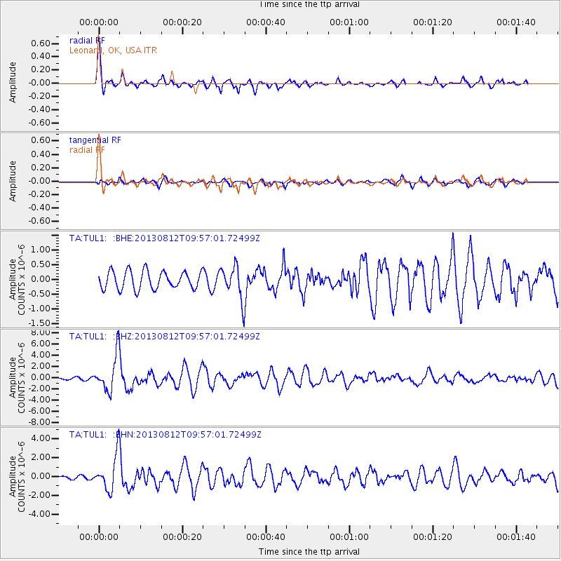
Earthquake location: Near Coast Of Northern Peru
Earthquake latitude/longitude: -5.4/-81.9
Earthquake time(UTC): 2013/08/12 (224) 09:49:32 GMT
Earthquake Depth: 10 km
Earthquake Magnitude: 6.2 MWW, 6.1 MWB, 6.2 MWW, 6.2 MWC, 6.3 MWC
Earthquake Catalog/Contributor: NEIC PDE/NEIC COMCAT
Network: TA USArray Transportable Network (new EarthScope stations)
Station: TUL1 Leonard, OK, USA
Lat/Lon: 35.91 N/95.79 W
Elevation: 256 m
Distance: 43.1 deg
Az: 343.459 deg
Baz: 159.563 deg
Ray Param: 0.07276906
Estimated Moho Depth: 63.0 km
Estimated Crust Vp/Vs: 1.99
Assumed Crust Vp: 6.498 km/s
Estimated Crust Vs: 3.265 km/s
Estimated Crust Poisson's Ratio: 0.33
Radial Match: 87.81878 %
Radial Bump: 400
Transverse Match: 69.39196 %
Transverse Bump: 400
SOD ConfigId: 626651
Insert Time: 2014-04-17 23:35:17.979 +0000
GWidth: 2.5
Max Bumps: 400
Tol: 0.001

Signal To Noise

ChannelStoNSTALTA
TA:TUL1: :BHZ:20130812T09:57:01.72499Z18.5793323.3690692E-61.8133424E-7
TA:TUL1: :BHN:20130812T09:57:01.72499Z13.1887521.946827E-61.4761267E-7
TA:TUL1: :BHE:20130812T09:57:01.72499Z1.91694535.744441E-72.996664E-7
Arrivals
Ps10 SECOND
PpPs27 SECOND
PsPs/PpSs37 SECOND