U49A Red Boiling Springs, TN, USA - Earthquake Result Viewer
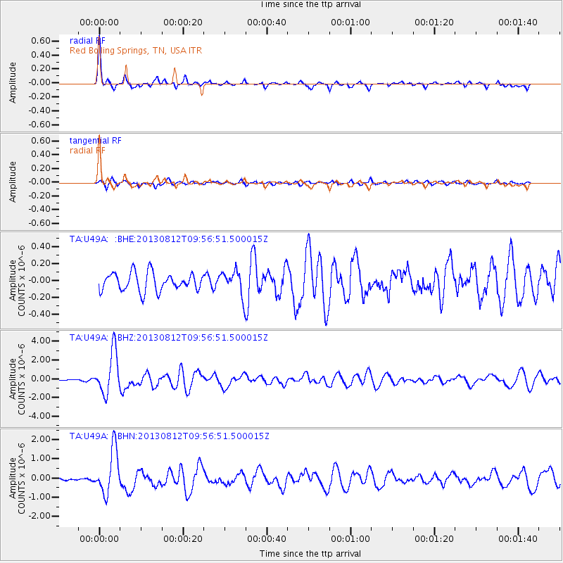
Earthquake location: Near Coast Of Northern Peru
Earthquake latitude/longitude: -5.4/-81.9
Earthquake time(UTC): 2013/08/12 (224) 09:49:32 GMT
Earthquake Depth: 10 km
Earthquake Magnitude: 6.2 MWW, 6.1 MWB, 6.2 MWW, 6.2 MWC, 6.3 MWC
Earthquake Catalog/Contributor: NEIC PDE/NEIC COMCAT
Network: TA USArray Transportable Network (new EarthScope stations)
Station: U49A Red Boiling Springs, TN, USA
Lat/Lon: 36.51 N/85.78 W
Elevation: 234 m
Distance: 41.8 deg
Az: 355.346 deg
Baz: 174.245 deg
Ray Param: 0.07353355
Estimated Moho Depth: 15.5 km
Estimated Crust Vp/Vs: 1.77
Assumed Crust Vp: 6.476 km/s
Estimated Crust Vs: 3.664 km/s
Estimated Crust Poisson's Ratio: 0.26
Radial Match: 84.63249 %
Radial Bump: 351
Transverse Match: 79.16148 %
Transverse Bump: 400
SOD ConfigId: 626651
Insert Time: 2014-04-17 23:35:22.352 +0000
GWidth: 2.5
Max Bumps: 400
Tol: 0.001

Signal To Noise

ChannelStoNSTALTA
TA:U49A: :BHZ:20130812T09:56:51.500015Z14.1338982.3130083E-61.636497E-7
TA:U49A: :BHN:20130812T09:56:51.500015Z7.41576531.1826532E-61.5947825E-7
TA:U49A: :BHE:20130812T09:56:51.500015Z1.43374921.5351287E-71.0707094E-7
Arrivals
Ps2.0 SECOND
PpPs6.2 SECOND
PsPs/PpSs8.1 SECOND