
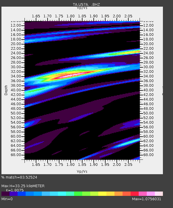
U57A Blanch, NC, USA - Earthquake Result Viewer
| ||||||||||||||||||
| ||||||||||||||||||
| ||||||||||||||||||
|
Signal To Noise
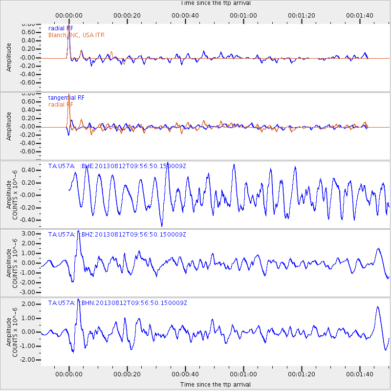
| Channel | StoN | STA | LTA |
| TA:U57A: :BHZ:20130812T09:56:50.150009Z | 9.826604 | 1.6191275E-6 | 1.6476979E-7 |
| TA:U57A: :BHN:20130812T09:56:50.150009Z | 10.137278 | 1.1295806E-6 | 1.1142839E-7 |
| TA:U57A: :BHE:20130812T09:56:50.150009Z | 1.3866187 | 2.9828945E-7 | 2.1512002E-7 |
| Arrivals | |
| Ps | 4.5 SECOND |
| PpPs | 14 SECOND |
| PsPs/PpSs | 18 SECOND |

