U59A Littleton, NC, USA - Earthquake Result Viewer
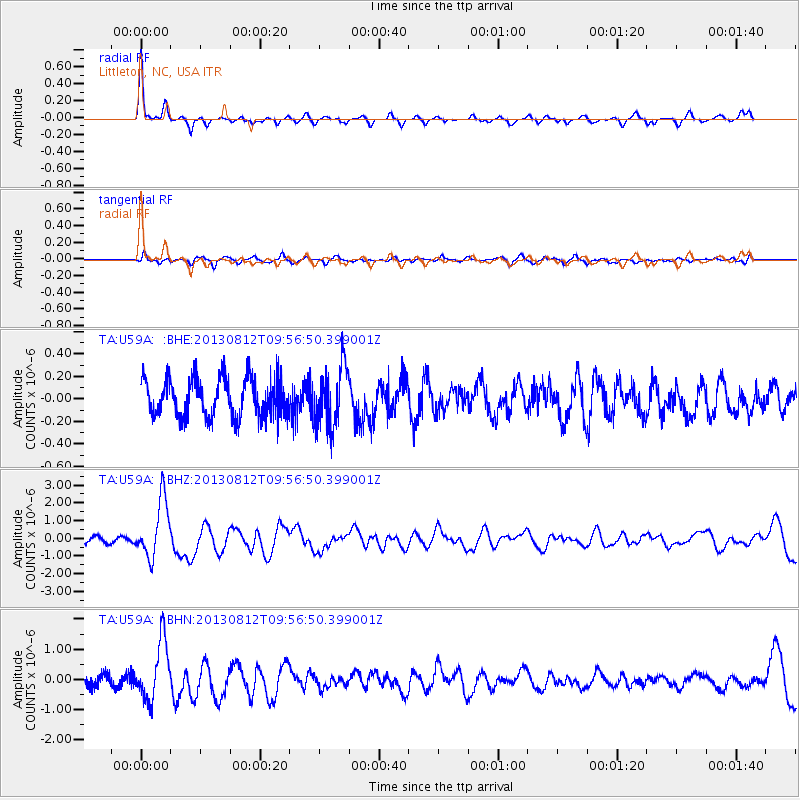
Earthquake location: Near Coast Of Northern Peru
Earthquake latitude/longitude: -5.4/-81.9
Earthquake time(UTC): 2013/08/12 (224) 09:49:32 GMT
Earthquake Depth: 10 km
Earthquake Magnitude: 6.2 MWW, 6.1 MWB, 6.2 MWW, 6.2 MWC, 6.3 MWC
Earthquake Catalog/Contributor: NEIC PDE/NEIC COMCAT
Network: TA USArray Transportable Network (new EarthScope stations)
Station: U59A Littleton, NC, USA
Lat/Lon: 36.35 N/77.79 W
Elevation: 99 m
Distance: 41.7 deg
Az: 5.018 deg
Baz: 186.193 deg
Ray Param: 0.07362039
Estimated Moho Depth: 35.0 km
Estimated Crust Vp/Vs: 1.72
Assumed Crust Vp: 6.565 km/s
Estimated Crust Vs: 3.811 km/s
Estimated Crust Poisson's Ratio: 0.25
Radial Match: 88.36927 %
Radial Bump: 400
Transverse Match: 64.03445 %
Transverse Bump: 400
SOD ConfigId: 626651
Insert Time: 2014-04-17 23:35:47.192 +0000
GWidth: 2.5
Max Bumps: 400
Tol: 0.001

Signal To Noise

ChannelStoNSTALTA
TA:U59A: :BHZ:20130812T09:56:50.399001Z10.8468641.6214518E-61.4948577E-7
TA:U59A: :BHN:20130812T09:56:50.399001Z6.41235359.715434E-71.515112E-7
TA:U59A: :BHE:20130812T09:56:50.399001Z1.57344832.6427236E-71.6795745E-7
Arrivals
Ps4.1 SECOND
PpPs13 SECOND
PsPs/PpSs18 SECOND