V50A Pikevile, TN, USA - Earthquake Result Viewer
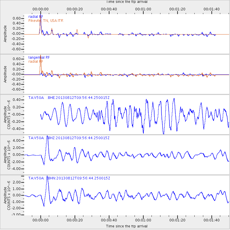
Earthquake location: Near Coast Of Northern Peru
Earthquake latitude/longitude: -5.4/-81.9
Earthquake time(UTC): 2013/08/12 (224) 09:49:32 GMT
Earthquake Depth: 10 km
Earthquake Magnitude: 6.2 MWW, 6.1 MWB, 6.2 MWW, 6.2 MWC, 6.3 MWC
Earthquake Catalog/Contributor: NEIC PDE/NEIC COMCAT
Network: TA USArray Transportable Network (new EarthScope stations)
Station: V50A Pikevile, TN, USA
Lat/Lon: 35.67 N/85.10 W
Elevation: 287 m
Distance: 41.0 deg
Az: 356.057 deg
Baz: 175.177 deg
Ray Param: 0.074090965
Estimated Moho Depth: 52.0 km
Estimated Crust Vp/Vs: 1.77
Assumed Crust Vp: 6.35 km/s
Estimated Crust Vs: 3.588 km/s
Estimated Crust Poisson's Ratio: 0.27
Radial Match: 90.91058 %
Radial Bump: 290
Transverse Match: 72.995476 %
Transverse Bump: 390
SOD ConfigId: 626651
Insert Time: 2014-04-17 23:35:58.752 +0000
GWidth: 2.5
Max Bumps: 400
Tol: 0.001

Signal To Noise

ChannelStoNSTALTA
TA:V50A: :BHZ:20130812T09:56:44.250015Z25.6256312.4779124E-69.669664E-8
TA:V50A: :BHN:20130812T09:56:44.250015Z16.1955621.3734815E-68.480604E-8
TA:V50A: :BHE:20130812T09:56:44.250015Z0.52871888.414182E-81.5914284E-7
Arrivals
Ps6.7 SECOND
PpPs21 SECOND
PsPs/PpSs28 SECOND