
V52A Sevierville, TN, USA - Earthquake Result Viewer
| ||||||||||||||||||
| ||||||||||||||||||
| ||||||||||||||||||
|
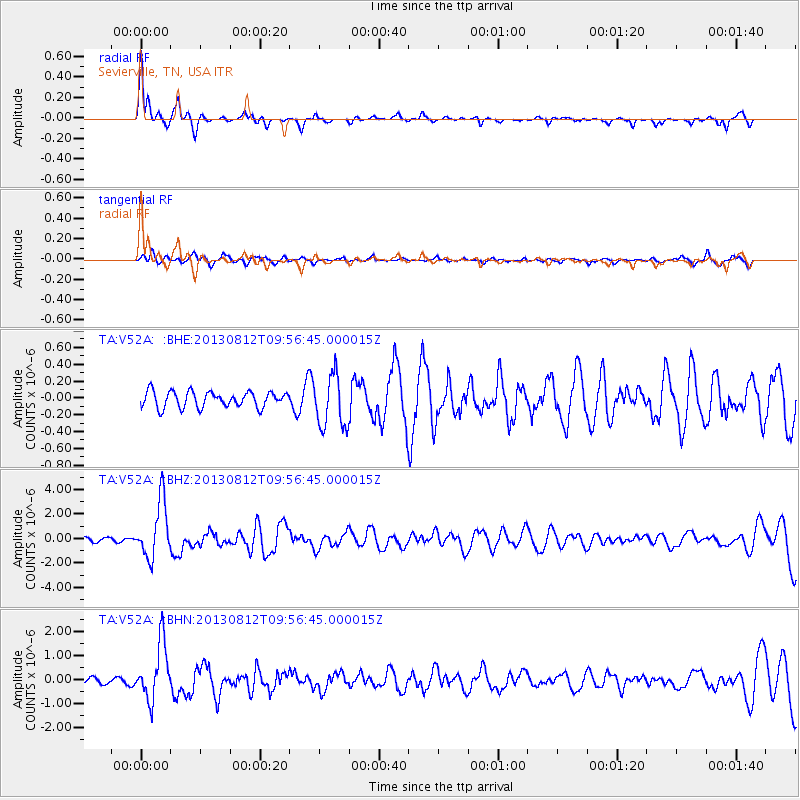
Signal To Noise
| Channel | StoN | STA | LTA |
| TA:V52A: :BHZ:20130812T09:56:45.000015Z | 11.879959 | 2.2799545E-6 | 1.9191603E-7 |
| TA:V52A: :BHN:20130812T09:56:45.000015Z | 7.8569603 | 1.169913E-6 | 1.4890149E-7 |
| TA:V52A: :BHE:20130812T09:56:45.000015Z | 3.3405256 | 3.1442255E-7 | 9.412368E-8 |
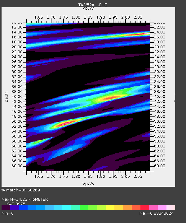
| Arrivals | |
| Ps | 2.6 SECOND |
| PpPs | 6.6 SECOND |
| PsPs/PpSs | 9.2 SECOND |

