V53A Saluda, NC, USA - Earthquake Result Viewer
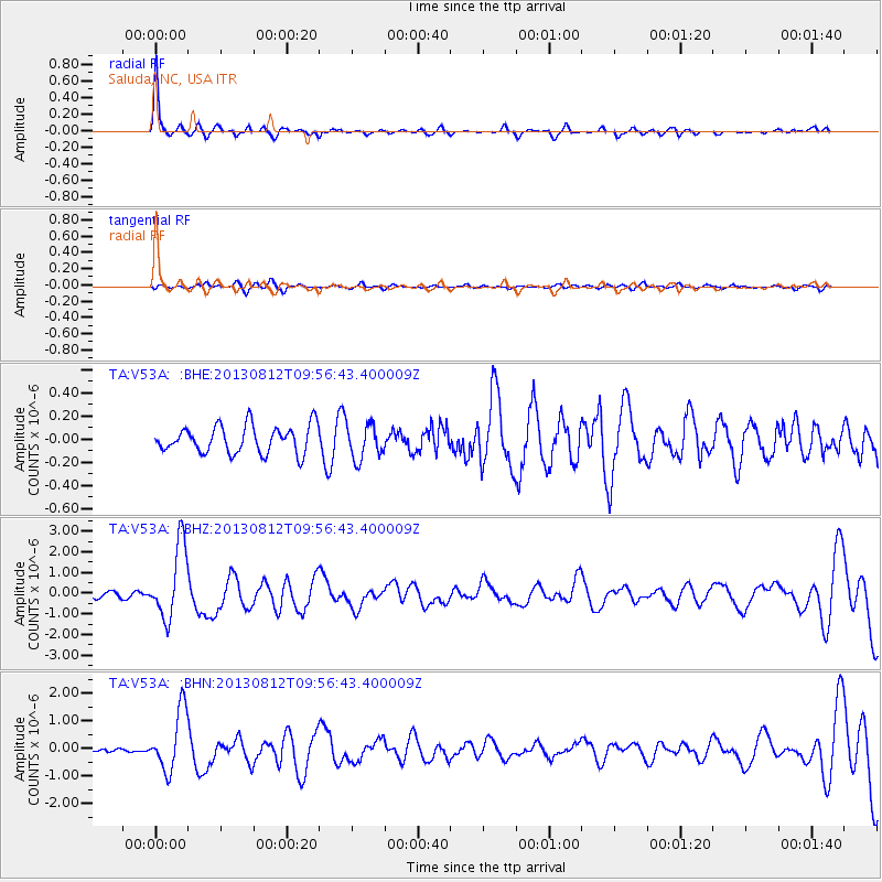
Earthquake location: Near Coast Of Northern Peru
Earthquake latitude/longitude: -5.4/-81.9
Earthquake time(UTC): 2013/08/12 (224) 09:49:32 GMT
Earthquake Depth: 10 km
Earthquake Magnitude: 6.2 MWW, 6.1 MWB, 6.2 MWW, 6.2 MWC, 6.3 MWC
Earthquake Catalog/Contributor: NEIC PDE/NEIC COMCAT
Network: TA USArray Transportable Network (new EarthScope stations)
Station: V53A Saluda, NC, USA
Lat/Lon: 35.67 N/82.81 W
Elevation: 681 m
Distance: 40.9 deg
Az: 358.898 deg
Baz: 178.652 deg
Ray Param: 0.074153095
Estimated Moho Depth: 37.5 km
Estimated Crust Vp/Vs: 1.61
Assumed Crust Vp: 6.35 km/s
Estimated Crust Vs: 3.944 km/s
Estimated Crust Poisson's Ratio: 0.19
Radial Match: 88.41517 %
Radial Bump: 319
Transverse Match: 54.35298 %
Transverse Bump: 400
SOD ConfigId: 626651
Insert Time: 2014-04-17 23:36:06.168 +0000
GWidth: 2.5
Max Bumps: 400
Tol: 0.001

Signal To Noise

ChannelStoNSTALTA
TA:V53A: :BHZ:20130812T09:56:43.400009Z9.5999661.774283E-61.848218E-7
TA:V53A: :BHN:20130812T09:56:43.400009Z6.40241241.094917E-61.7101632E-7
TA:V53A: :BHE:20130812T09:56:43.400009Z1.27245141.5032741E-71.18139994E-7
Arrivals
Ps3.9 SECOND
PpPs14 SECOND
PsPs/PpSs18 SECOND