
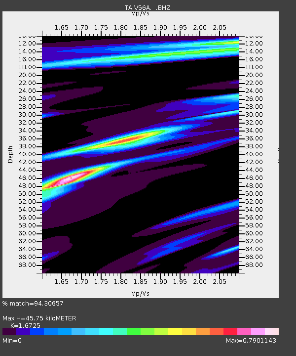
V56A Mocksville, NC, USA - Earthquake Result Viewer
| ||||||||||||||||||
| ||||||||||||||||||
| ||||||||||||||||||
|
Signal To Noise
| Channel | StoN | STA | LTA |
| TA:V56A: :BHZ:20130812T09:56:44.650009Z | 9.685265 | 2.0030627E-6 | 2.0681547E-7 |
| TA:V56A: :BHN:20130812T09:56:44.650009Z | 10.26714 | 1.4939112E-6 | 1.4550412E-7 |
| TA:V56A: :BHE:20130812T09:56:44.650009Z | 1.3370782 | 2.300228E-7 | 1.7203392E-7 |
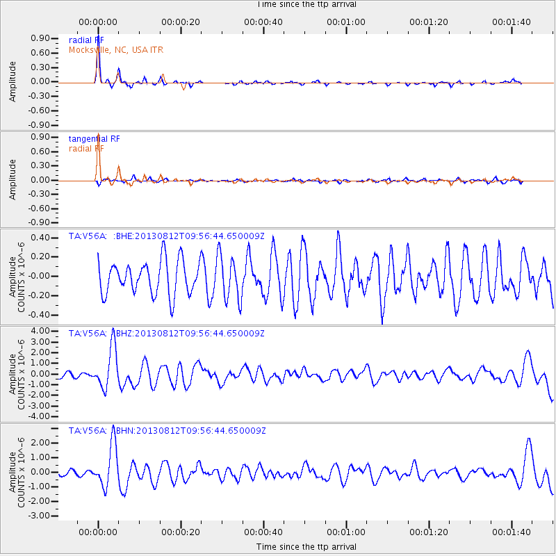
| Arrivals | |
| Ps | 5.2 SECOND |
| PpPs | 18 SECOND |
| PsPs/PpSs | 23 SECOND |

