W49A Belvidere, TN, USA - Earthquake Result Viewer
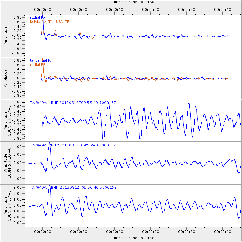
Earthquake location: Near Coast Of Northern Peru
Earthquake latitude/longitude: -5.4/-81.9
Earthquake time(UTC): 2013/08/12 (224) 09:49:32 GMT
Earthquake Depth: 10 km
Earthquake Magnitude: 6.2 MWW, 6.1 MWB, 6.2 MWW, 6.2 MWC, 6.3 MWC
Earthquake Catalog/Contributor: NEIC PDE/NEIC COMCAT
Network: TA USArray Transportable Network (new EarthScope stations)
Station: W49A Belvidere, TN, USA
Lat/Lon: 35.12 N/86.26 W
Elevation: 251 m
Distance: 40.5 deg
Az: 354.522 deg
Baz: 173.342 deg
Ray Param: 0.07436273
Estimated Moho Depth: 54.25 km
Estimated Crust Vp/Vs: 1.60
Assumed Crust Vp: 6.476 km/s
Estimated Crust Vs: 4.047 km/s
Estimated Crust Poisson's Ratio: 0.18
Radial Match: 95.71803 %
Radial Bump: 245
Transverse Match: 87.748795 %
Transverse Bump: 400
SOD ConfigId: 626651
Insert Time: 2014-04-17 23:36:37.878 +0000
GWidth: 2.5
Max Bumps: 400
Tol: 0.001

Signal To Noise

ChannelStoNSTALTA
TA:W49A: :BHZ:20130812T09:56:40.500015Z26.0631662.2738616E-68.724426E-8
TA:W49A: :BHN:20130812T09:56:40.500015Z20.8880751.6453477E-67.876971E-8
TA:W49A: :BHE:20130812T09:56:40.500015Z4.96680364.54612E-79.1530104E-8
Arrivals
Ps5.4 SECOND
PpPs20 SECOND
PsPs/PpSs26 SECOND