W52A Murphy, NC, USA - Earthquake Result Viewer
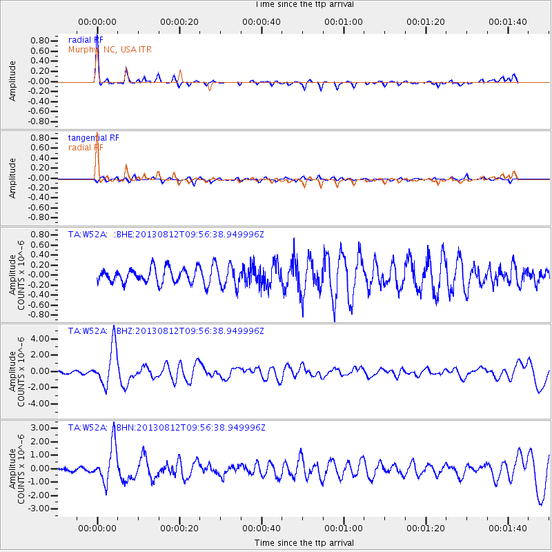
Earthquake location: Near Coast Of Northern Peru
Earthquake latitude/longitude: -5.4/-81.9
Earthquake time(UTC): 2013/08/12 (224) 09:49:32 GMT
Earthquake Depth: 10 km
Earthquake Magnitude: 6.2 MWW, 6.1 MWB, 6.2 MWW, 6.2 MWC, 6.3 MWC
Earthquake Catalog/Contributor: NEIC PDE/NEIC COMCAT
Network: TA USArray Transportable Network (new EarthScope stations)
Station: W52A Murphy, NC, USA
Lat/Lon: 35.09 N/83.93 W
Elevation: 519 m
Distance: 40.3 deg
Az: 357.464 deg
Baz: 176.92 deg
Ray Param: 0.07446753
Estimated Moho Depth: 17.75 km
Estimated Crust Vp/Vs: 1.74
Assumed Crust Vp: 6.35 km/s
Estimated Crust Vs: 3.66 km/s
Estimated Crust Poisson's Ratio: 0.25
Radial Match: 88.757286 %
Radial Bump: 254
Transverse Match: 75.29788 %
Transverse Bump: 400
SOD ConfigId: 626651
Insert Time: 2014-04-17 23:36:43.607 +0000
GWidth: 2.5
Max Bumps: 400
Tol: 0.001

Signal To Noise

ChannelStoNSTALTA
TA:W52A: :BHZ:20130812T09:56:38.949996Z15.9285092.462807E-61.546163E-7
TA:W52A: :BHN:20130812T09:56:38.949996Z18.7215921.4672167E-67.83703E-8
TA:W52A: :BHE:20130812T09:56:38.949996Z1.50231532.1104904E-71.4048253E-7
Arrivals
Ps2.2 SECOND
PpPs7.1 SECOND
PsPs/PpSs9.3 SECOND