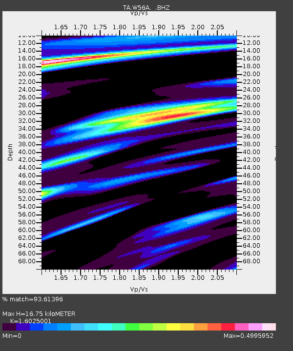
W56A Indian Trail, NC, USA - Earthquake Result Viewer

Earthquake location: Near Coast Of Northern Peru
Earthquake latitude/longitude: -5.4/-81.9
Earthquake time(UTC): 2013/08/12 (224) 09:49:32 GMT
Earthquake Depth: 10 km
Earthquake Magnitude: 6.2 MWW, 6.1 MWB, 6.2 MWW, 6.2 MWC, 6.3 MWC
Earthquake Catalog/Contributor: NEIC PDE/NEIC COMCAT
Network: TA USArray Transportable Network (new EarthScope stations)
Station: W56A Indian Trail, NC, USA
Lat/Lon: 35.13 N/80.58 W
Elevation: 177 m
Distance: 40.3 deg
Az: 1.702 deg
Baz: 182.068 deg
Ray Param: 0.074458346
Estimated Moho Depth: 16.75 km
Estimated Crust Vp/Vs: 1.60
Assumed Crust Vp: 6.419 km/s
Estimated Crust Vs: 4.006 km/s
Estimated Crust Poisson's Ratio: 0.18
Radial Match: 93.61396 %
Radial Bump: 255
Transverse Match: 68.309074 %
Transverse Bump: 400
SOD ConfigId: 626651
Insert Time: 2014-04-17 23:36:52.672 +0000
GWidth: 2.5
Max Bumps: 400
Tol: 0.001

Signal To Noise

ChannelStoNSTALTA
TA:W56A: :BHZ:20130812T09:56:39.09999Z10.3189281.7265373E-61.6731751E-7
TA:W56A: :BHN:20130812T09:56:39.09999Z11.799591.0729162E-69.092827E-8
TA:W56A: :BHE:20130812T09:56:39.09999Z0.899673161.1471398E-71.2750627E-7
Arrivals
Ps1.7 SECOND
PpPs6.3 SECOND
PsPs/PpSs8.0 SECOND