
W59A Clinton, NC, USA - Earthquake Result Viewer
| ||||||||||||||||||
| ||||||||||||||||||
| ||||||||||||||||||
|
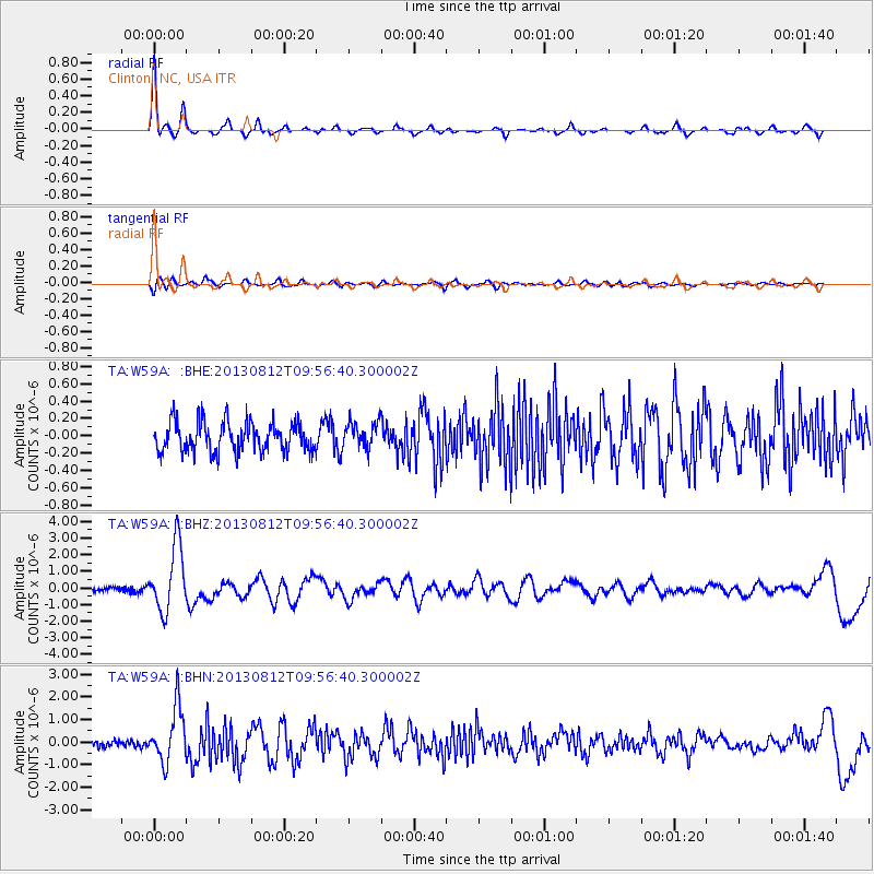
Signal To Noise
| Channel | StoN | STA | LTA |
| TA:W59A: :BHZ:20130812T09:56:40.300002Z | 16.104244 | 1.967697E-6 | 1.22185E-7 |
| TA:W59A: :BHN:20130812T09:56:40.300002Z | 9.198682 | 1.2010097E-6 | 1.3056324E-7 |
| TA:W59A: :BHE:20130812T09:56:40.300002Z | 0.86009437 | 1.4929711E-7 | 1.7358224E-7 |
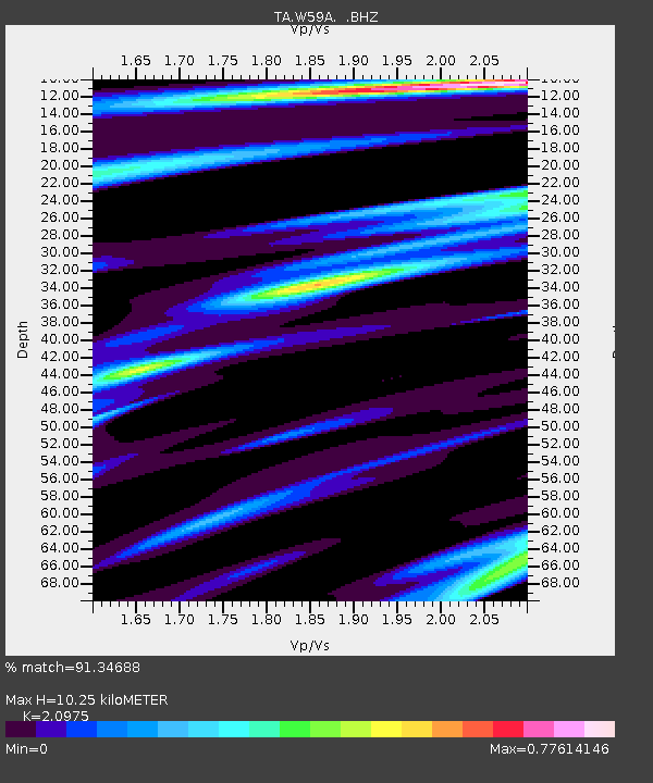
| Arrivals | |
| Ps | 1.8 SECOND |
| PpPs | 4.5 SECOND |
| PsPs/PpSs | 6.4 SECOND |

