W60A Pink Hill, NC, USA - Earthquake Result Viewer
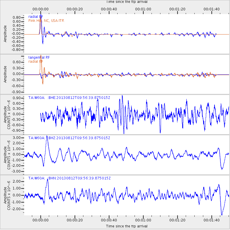
Earthquake location: Near Coast Of Northern Peru
Earthquake latitude/longitude: -5.4/-81.9
Earthquake time(UTC): 2013/08/12 (224) 09:49:32 GMT
Earthquake Depth: 10 km
Earthquake Magnitude: 6.2 MWW, 6.1 MWB, 6.2 MWW, 6.2 MWC, 6.3 MWC
Earthquake Catalog/Contributor: NEIC PDE/NEIC COMCAT
Network: TA USArray Transportable Network (new EarthScope stations)
Station: W60A Pink Hill, NC, USA
Lat/Lon: 35.05 N/77.71 W
Elevation: 30 m
Distance: 40.4 deg
Az: 5.334 deg
Baz: 186.477 deg
Ray Param: 0.07440832
Estimated Moho Depth: 13.5 km
Estimated Crust Vp/Vs: 2.05
Assumed Crust Vp: 6.565 km/s
Estimated Crust Vs: 3.202 km/s
Estimated Crust Poisson's Ratio: 0.34
Radial Match: 86.0645 %
Radial Bump: 400
Transverse Match: 51.17769 %
Transverse Bump: 400
SOD ConfigId: 626651
Insert Time: 2014-04-17 23:37:01.927 +0000
GWidth: 2.5
Max Bumps: 400
Tol: 0.001

Signal To Noise

ChannelStoNSTALTA
TA:W60A: :BHZ:20130812T09:56:39.875015Z8.8444261.5831453E-61.789992E-7
TA:W60A: :BHN:20130812T09:56:39.875015Z6.06297641.089473E-61.7969276E-7
TA:W60A: :BHE:20130812T09:56:39.875015Z1.68490454.0850705E-72.4245116E-7
Arrivals
Ps2.3 SECOND
PpPs5.9 SECOND
PsPs/PpSs8.2 SECOND