
X48A Hartselle, AL, USA - Earthquake Result Viewer
| ||||||||||||||||||
| ||||||||||||||||||
| ||||||||||||||||||
|
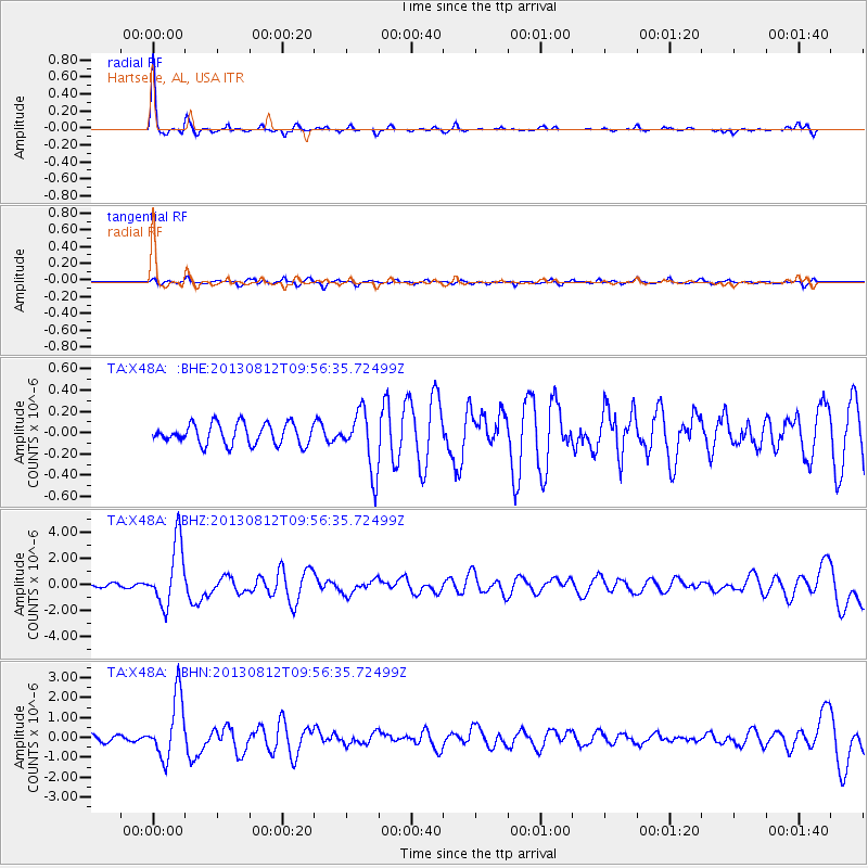
Signal To Noise
| Channel | StoN | STA | LTA |
| TA:X48A: :BHZ:20130812T09:56:35.72499Z | 26.087315 | 2.4275146E-6 | 9.305345E-8 |
| TA:X48A: :BHN:20130812T09:56:35.72499Z | 10.407864 | 1.5506886E-6 | 1.4899202E-7 |
| TA:X48A: :BHE:20130812T09:56:35.72499Z | 2.8525221 | 2.7984888E-7 | 9.810577E-8 |
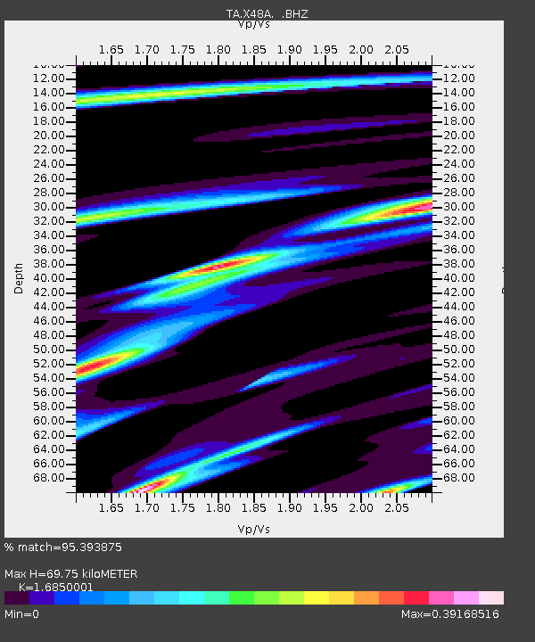
| Arrivals | |
| Ps | 8.0 SECOND |
| PpPs | 27 SECOND |
| PsPs/PpSs | 35 SECOND |

