X52A Dahlonega, GA, USA - Earthquake Result Viewer
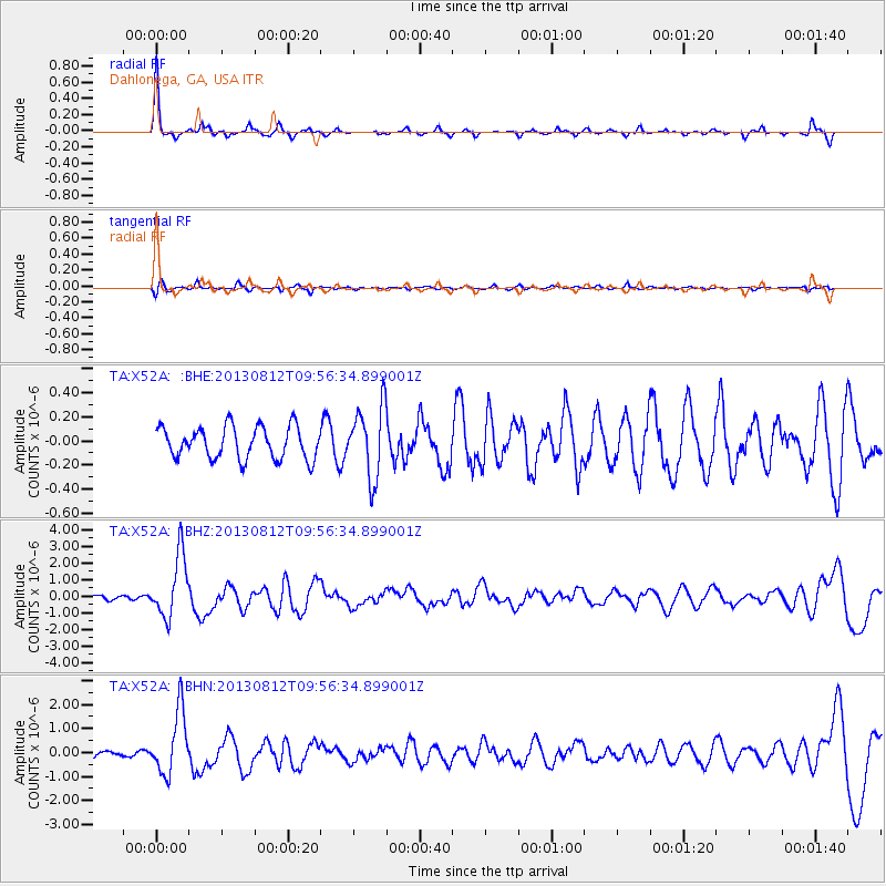
Earthquake location: Near Coast Of Northern Peru
Earthquake latitude/longitude: -5.4/-81.9
Earthquake time(UTC): 2013/08/12 (224) 09:49:32 GMT
Earthquake Depth: 10 km
Earthquake Magnitude: 6.2 MWW, 6.1 MWB, 6.2 MWW, 6.2 MWC, 6.3 MWC
Earthquake Catalog/Contributor: NEIC PDE/NEIC COMCAT
Network: TA USArray Transportable Network (new EarthScope stations)
Station: X52A Dahlonega, GA, USA
Lat/Lon: 34.60 N/83.89 W
Elevation: 481 m
Distance: 39.8 deg
Az: 357.466 deg
Baz: 176.941 deg
Ray Param: 0.07475673
Estimated Moho Depth: 42.25 km
Estimated Crust Vp/Vs: 2.00
Assumed Crust Vp: 6.35 km/s
Estimated Crust Vs: 3.183 km/s
Estimated Crust Poisson's Ratio: 0.33
Radial Match: 88.696785 %
Radial Bump: 227
Transverse Match: 65.40847 %
Transverse Bump: 400
SOD ConfigId: 626651
Insert Time: 2014-04-17 23:37:17.387 +0000
GWidth: 2.5
Max Bumps: 400
Tol: 0.001

Signal To Noise

ChannelStoNSTALTA
TA:X52A: :BHZ:20130812T09:56:34.899001Z12.0364931.8705073E-61.5540301E-7
TA:X52A: :BHN:20130812T09:56:34.899001Z7.51368671.3066478E-61.7390236E-7
TA:X52A: :BHE:20130812T09:56:34.899001Z2.23060322.9509843E-71.3229534E-7
Arrivals
Ps7.0 SECOND
PpPs19 SECOND
PsPs/PpSs26 SECOND