X54A Belton, SC, USA - Earthquake Result Viewer
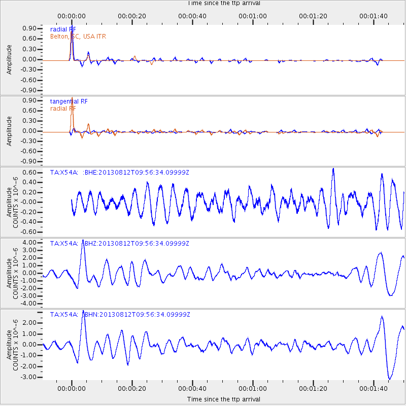
Earthquake location: Near Coast Of Northern Peru
Earthquake latitude/longitude: -5.4/-81.9
Earthquake time(UTC): 2013/08/12 (224) 09:49:32 GMT
Earthquake Depth: 10 km
Earthquake Magnitude: 6.2 MWW, 6.1 MWB, 6.2 MWW, 6.2 MWC, 6.3 MWC
Earthquake Catalog/Contributor: NEIC PDE/NEIC COMCAT
Network: TA USArray Transportable Network (new EarthScope stations)
Station: X54A Belton, SC, USA
Lat/Lon: 34.55 N/82.37 W
Elevation: 213 m
Distance: 39.7 deg
Az: 359.422 deg
Baz: 179.303 deg
Ray Param: 0.074815534
Estimated Moho Depth: 51.75 km
Estimated Crust Vp/Vs: 1.63
Assumed Crust Vp: 6.35 km/s
Estimated Crust Vs: 3.89 km/s
Estimated Crust Poisson's Ratio: 0.20
Radial Match: 93.24407 %
Radial Bump: 185
Transverse Match: 50.848076 %
Transverse Bump: 400
SOD ConfigId: 626651
Insert Time: 2014-04-17 23:37:26.226 +0000
GWidth: 2.5
Max Bumps: 400
Tol: 0.001

Signal To Noise

ChannelStoNSTALTA
TA:X54A: :BHZ:20130812T09:56:34.09999Z7.8399162.013904E-62.5687825E-7
TA:X54A: :BHN:20130812T09:56:34.09999Z6.3752031.4879535E-62.3339703E-7
TA:X54A: :BHE:20130812T09:56:34.09999Z1.83190172.658828E-71.4514032E-7
Arrivals
Ps5.6 SECOND
PpPs20 SECOND
PsPs/PpSs25 SECOND