Y51A Rockmart, GA, USA - Earthquake Result Viewer
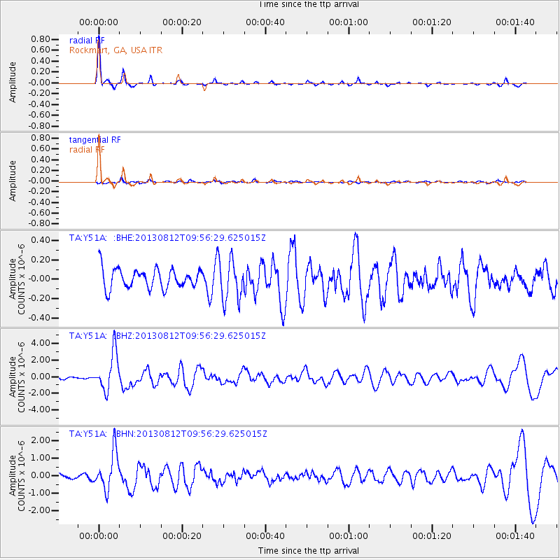
Earthquake location: Near Coast Of Northern Peru
Earthquake latitude/longitude: -5.4/-81.9
Earthquake time(UTC): 2013/08/12 (224) 09:49:32 GMT
Earthquake Depth: 10 km
Earthquake Magnitude: 6.2 MWW, 6.1 MWB, 6.2 MWW, 6.2 MWC, 6.3 MWC
Earthquake Catalog/Contributor: NEIC PDE/NEIC COMCAT
Network: TA USArray Transportable Network (new EarthScope stations)
Station: Y51A Rockmart, GA, USA
Lat/Lon: 33.90 N/85.06 W
Elevation: 380 m
Distance: 39.2 deg
Az: 355.869 deg
Baz: 175.054 deg
Ray Param: 0.075125016
Estimated Moho Depth: 53.0 km
Estimated Crust Vp/Vs: 1.70
Assumed Crust Vp: 6.719 km/s
Estimated Crust Vs: 3.953 km/s
Estimated Crust Poisson's Ratio: 0.24
Radial Match: 91.997314 %
Radial Bump: 225
Transverse Match: 51.79018 %
Transverse Bump: 400
SOD ConfigId: 626651
Insert Time: 2014-04-17 23:37:57.091 +0000
GWidth: 2.5
Max Bumps: 400
Tol: 0.001

Signal To Noise

ChannelStoNSTALTA
TA:Y51A: :BHZ:20130812T09:56:29.625015Z10.0411152.3827563E-62.3729996E-7
TA:Y51A: :BHN:20130812T09:56:29.625015Z8.0801081.1114062E-61.3754844E-7
TA:Y51A: :BHE:20130812T09:56:29.625015Z2.05022862.0767251E-71.0129237E-7
Arrivals
Ps6.0 SECOND
PpPs20 SECOND
PsPs/PpSs26 SECOND