
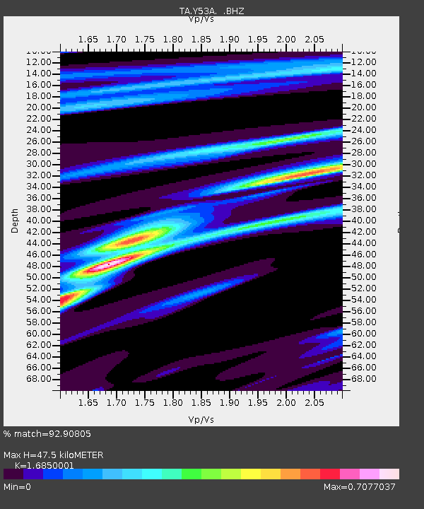
Y53A Monroe, GA, USA - Earthquake Result Viewer
| ||||||||||||||||||
| ||||||||||||||||||
| ||||||||||||||||||
|
Signal To Noise
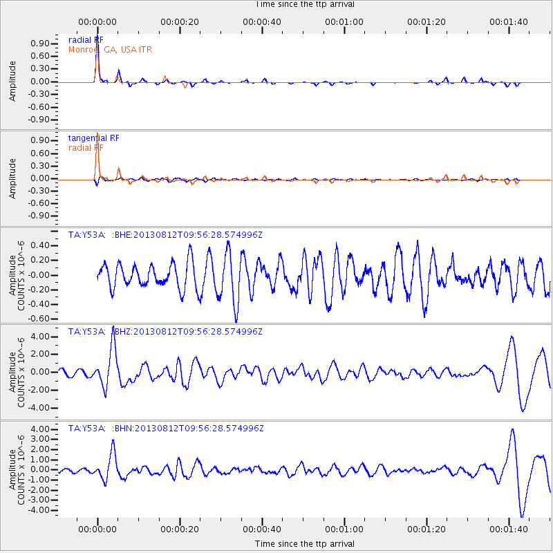
| Channel | StoN | STA | LTA |
| TA:Y53A: :BHZ:20130812T09:56:28.574996Z | 8.00123 | 2.2593638E-6 | 2.8237707E-7 |
| TA:Y53A: :BHN:20130812T09:56:28.574996Z | 8.135355 | 1.3075988E-6 | 1.607304E-7 |
| TA:Y53A: :BHE:20130812T09:56:28.574996Z | 2.137142 | 3.4623565E-7 | 1.6200873E-7 |
| Arrivals | |
| Ps | 5.4 SECOND |
| PpPs | 18 SECOND |
| PsPs/PpSs | 23 SECOND |

