
Y55A Saluda, SC, USA - Earthquake Result Viewer
| ||||||||||||||||||
| ||||||||||||||||||
| ||||||||||||||||||
|
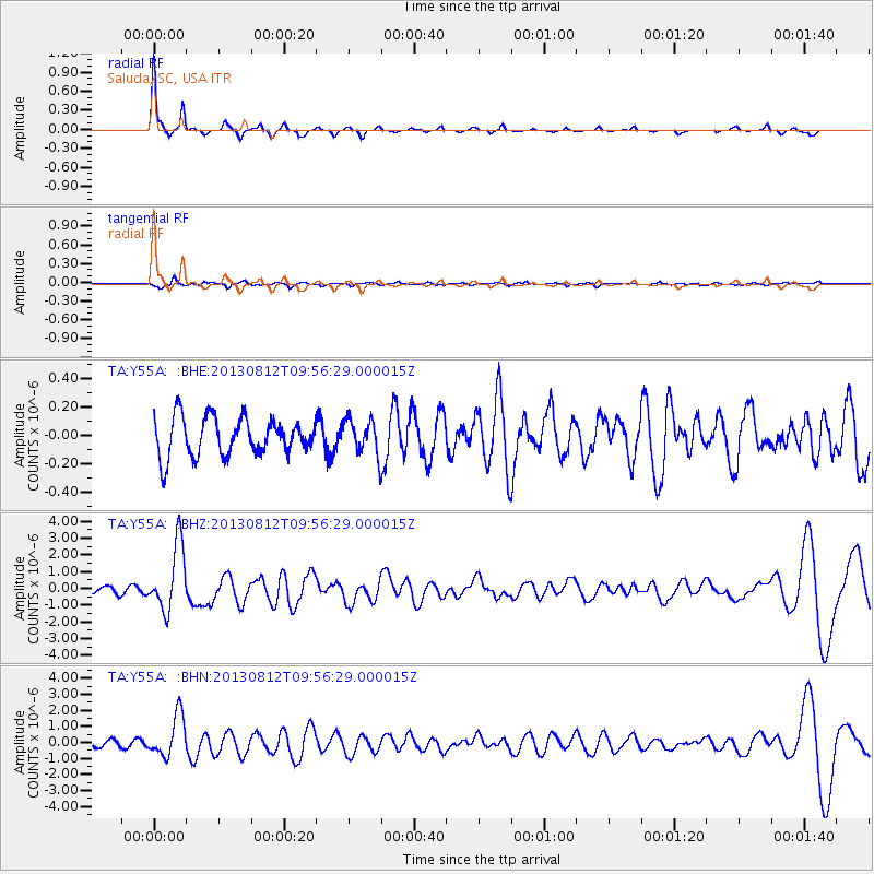
Signal To Noise
| Channel | StoN | STA | LTA |
| TA:Y55A: :BHZ:20130812T09:56:29.000015Z | 12.125733 | 1.9805673E-6 | 1.6333588E-7 |
| TA:Y55A: :BHN:20130812T09:56:29.000015Z | 8.533465 | 1.2978602E-6 | 1.5209062E-7 |
| TA:Y55A: :BHE:20130812T09:56:29.000015Z | 0.904579 | 1.2103966E-7 | 1.3380773E-7 |
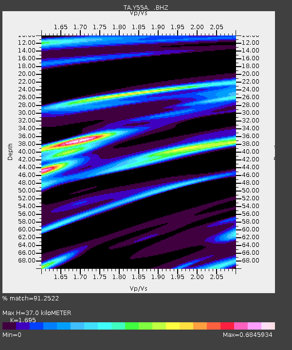
| Arrivals | |
| Ps | 4.2 SECOND |
| PpPs | 14 SECOND |
| PsPs/PpSs | 18 SECOND |

