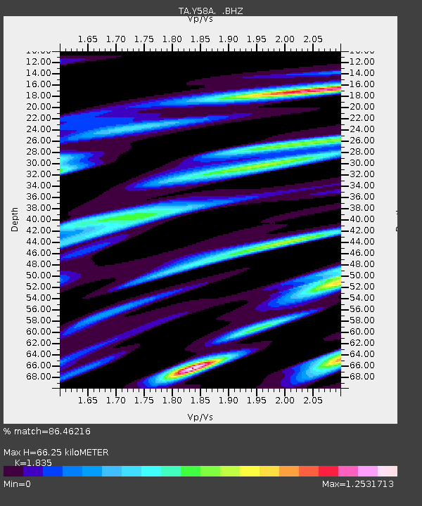
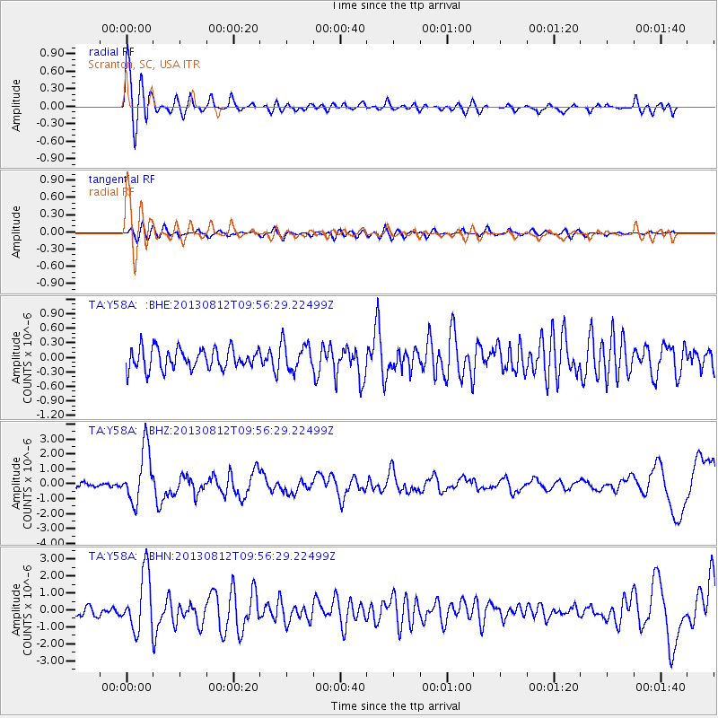
Y58A Scranton, SC, USA - Earthquake Result Viewer

Earthquake location: Near Coast Of Northern Peru
Earthquake latitude/longitude: -5.4/-81.9
Earthquake time(UTC): 2013/08/12 (224) 09:49:32 GMT
Earthquake Depth: 10 km
Earthquake Magnitude: 6.2 MWW, 6.1 MWB, 6.2 MWW, 6.2 MWC, 6.3 MWC
Earthquake Catalog/Contributor: NEIC PDE/NEIC COMCAT
Network: TA USArray Transportable Network (new EarthScope stations)
Station: Y58A Scranton, SC, USA
Lat/Lon: 33.91 N/79.67 W
Elevation: 19 m
Distance: 39.1 deg
Az: 2.978 deg
Baz: 183.566 deg
Ray Param: 0.075152606
Estimated Moho Depth: 66.25 km
Estimated Crust Vp/Vs: 1.84
Assumed Crust Vp: 6.24 km/s
Estimated Crust Vs: 3.401 km/s
Estimated Crust Poisson's Ratio: 0.29
Radial Match: 86.46216 %
Radial Bump: 400
Transverse Match: 55.958893 %
Transverse Bump: 400
SOD ConfigId: 626651
Insert Time: 2014-04-17 23:38:10.921 +0000
GWidth: 2.5
Max Bumps: 400
Tol: 0.001

Signal To Noise

ChannelStoNSTALTA
TA:Y58A: :BHZ:20130812T09:56:29.22499Z13.7748471.8151022E-61.3176933E-7
TA:Y58A: :BHN:20130812T09:56:29.22499Z5.6146991.7165582E-63.057258E-7
TA:Y58A: :BHE:20130812T09:56:29.22499Z1.3504922.8622085E-72.1193821E-7
Arrivals
Ps9.5 SECOND
PpPs28 SECOND
PsPs/PpSs38 SECOND