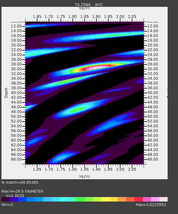
Z56A Williston, SC, USA - Earthquake Result Viewer
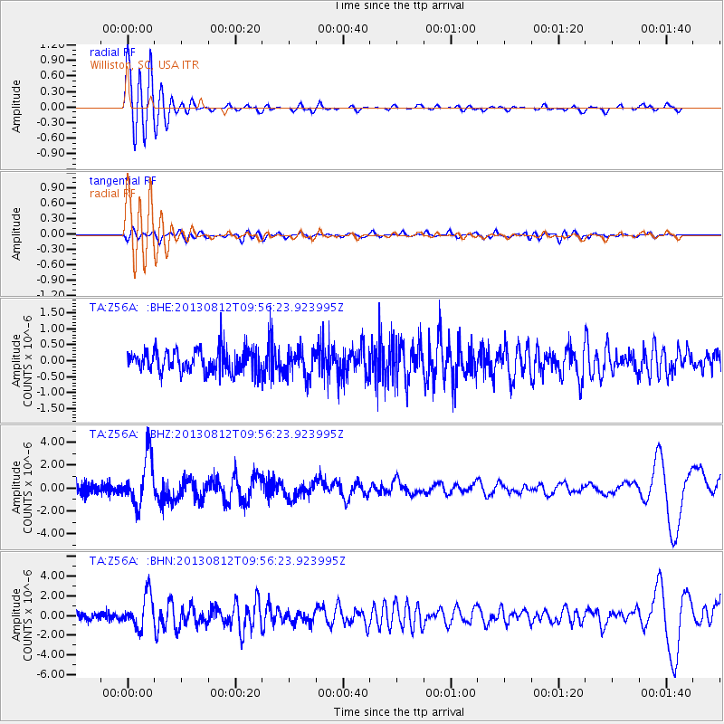
Earthquake location: Near Coast Of Northern Peru
Earthquake latitude/longitude: -5.4/-81.9
Earthquake time(UTC): 2013/08/12 (224) 09:49:32 GMT
Earthquake Depth: 10 km
Earthquake Magnitude: 6.2 MWW, 6.1 MWB, 6.2 MWW, 6.2 MWC, 6.3 MWC
Earthquake Catalog/Contributor: NEIC PDE/NEIC COMCAT
Network: TA USArray Transportable Network (new EarthScope stations)
Station: Z56A Williston, SC, USA
Lat/Lon: 33.33 N/81.37 W
Elevation: 81 m
Distance: 38.5 deg
Az: 0.75 deg
Baz: 180.892 deg
Ray Param: 0.07551867
Estimated Moho Depth: 29.5 km
Estimated Crust Vp/Vs: 1.90
Assumed Crust Vp: 6.565 km/s
Estimated Crust Vs: 3.45 km/s
Estimated Crust Poisson's Ratio: 0.31
Radial Match: 88.65385 %
Radial Bump: 400
Transverse Match: 62.02872 %
Transverse Bump: 400
SOD ConfigId: 626651
Insert Time: 2014-04-17 23:38:32.047 +0000
GWidth: 2.5
Max Bumps: 400
Tol: 0.001

Signal To Noise

ChannelStoNSTALTA
TA:Z56A: :BHZ:20130812T09:56:23.923995Z6.85775762.1808728E-63.1801545E-7
TA:Z56A: :BHN:20130812T09:56:23.923995Z6.58625461.6961425E-62.575276E-7
TA:Z56A: :BHE:20130812T09:56:23.923995Z1.18937424.1934166E-73.5257335E-7
Arrivals
Ps4.4 SECOND
PpPs12 SECOND
PsPs/PpSs17 SECOND