AGMN Agassiz National Wildlife Refuge, Minnesota, USA - Earthquake Result Viewer
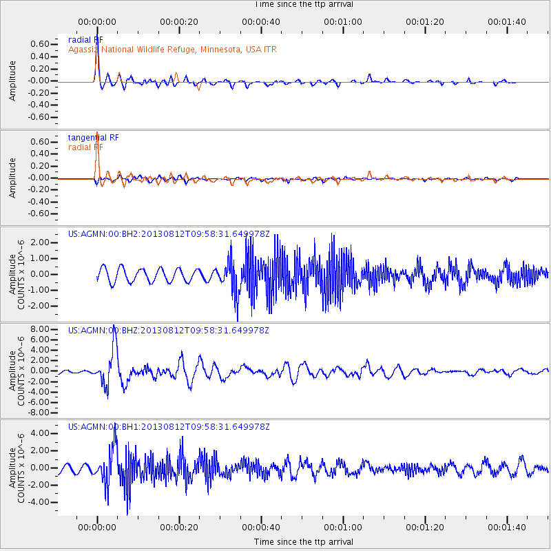
Earthquake location: Near Coast Of Northern Peru
Earthquake latitude/longitude: -5.4/-81.9
Earthquake time(UTC): 2013/08/12 (224) 09:49:32 GMT
Earthquake Depth: 10 km
Earthquake Magnitude: 6.2 MWW, 6.1 MWB, 6.2 MWW, 6.2 MWC, 6.3 MWC
Earthquake Catalog/Contributor: NEIC PDE/NEIC COMCAT
Network: US United States National Seismic Network
Station: AGMN Agassiz National Wildlife Refuge, Minnesota, USA
Lat/Lon: 48.30 N/95.86 W
Elevation: 351 m
Distance: 54.8 deg
Az: 348.658 deg
Baz: 162.948 deg
Ray Param: 0.06518449
Estimated Moho Depth: 20.0 km
Estimated Crust Vp/Vs: 1.83
Assumed Crust Vp: 6.419 km/s
Estimated Crust Vs: 3.513 km/s
Estimated Crust Poisson's Ratio: 0.29
Radial Match: 91.90697 %
Radial Bump: 343
Transverse Match: 74.99126 %
Transverse Bump: 400
SOD ConfigId: 626651
Insert Time: 2014-04-17 23:38:51.591 +0000
GWidth: 2.5
Max Bumps: 400
Tol: 0.001

Signal To Noise

ChannelStoNSTALTA
US:AGMN:00:BHZ:20130812T09:58:31.649978Z12.9614283.747004E-62.8908886E-7
US:AGMN:00:BH1:20130812T09:58:31.649978Z6.93458942.136931E-63.081554E-7
US:AGMN:00:BH2:20130812T09:58:31.649978Z2.53198361.0308459E-64.0712976E-7
Arrivals
Ps2.7 SECOND
PpPs8.4 SECOND
PsPs/PpSs11 SECOND