EGMT Eagleton, Montana, USA - Earthquake Result Viewer
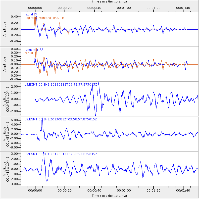
Earthquake location: Near Coast Of Northern Peru
Earthquake latitude/longitude: -5.4/-81.9
Earthquake time(UTC): 2013/08/12 (224) 09:49:32 GMT
Earthquake Depth: 10 km
Earthquake Magnitude: 6.2 MWW, 6.1 MWB, 6.2 MWW, 6.2 MWC, 6.3 MWC
Earthquake Catalog/Contributor: NEIC PDE/NEIC COMCAT
Network: US United States National Seismic Network
Station: EGMT Eagleton, Montana, USA
Lat/Lon: 48.02 N/109.75 W
Elevation: 1055 m
Distance: 58.5 deg
Az: 338.447 deg
Baz: 146.986 deg
Ray Param: 0.06277473
Estimated Moho Depth: 16.25 km
Estimated Crust Vp/Vs: 1.72
Assumed Crust Vp: 6.438 km/s
Estimated Crust Vs: 3.737 km/s
Estimated Crust Poisson's Ratio: 0.25
Radial Match: 89.385445 %
Radial Bump: 400
Transverse Match: 70.14134 %
Transverse Bump: 400
SOD ConfigId: 626651
Insert Time: 2014-04-17 23:39:32.799 +0000
GWidth: 2.5
Max Bumps: 400
Tol: 0.001

Signal To Noise

ChannelStoNSTALTA
US:EGMT:00:BHZ:20130812T09:58:57.875015Z12.9331172.4077208E-61.8616709E-7
US:EGMT:00:BH1:20130812T09:58:57.875015Z2.94730286.2235574E-72.1116111E-7
US:EGMT:00:BH2:20130812T09:58:57.875015Z1.88971564.352497E-72.3032551E-7
Arrivals
Ps1.9 SECOND
PpPs6.5 SECOND
PsPs/PpSs8.5 SECOND