You are here: Home > Network List > US - United States National Seismic Network Stations List
> Station GLMI Grayling, Michigan, USA > Earthquake Result Viewer
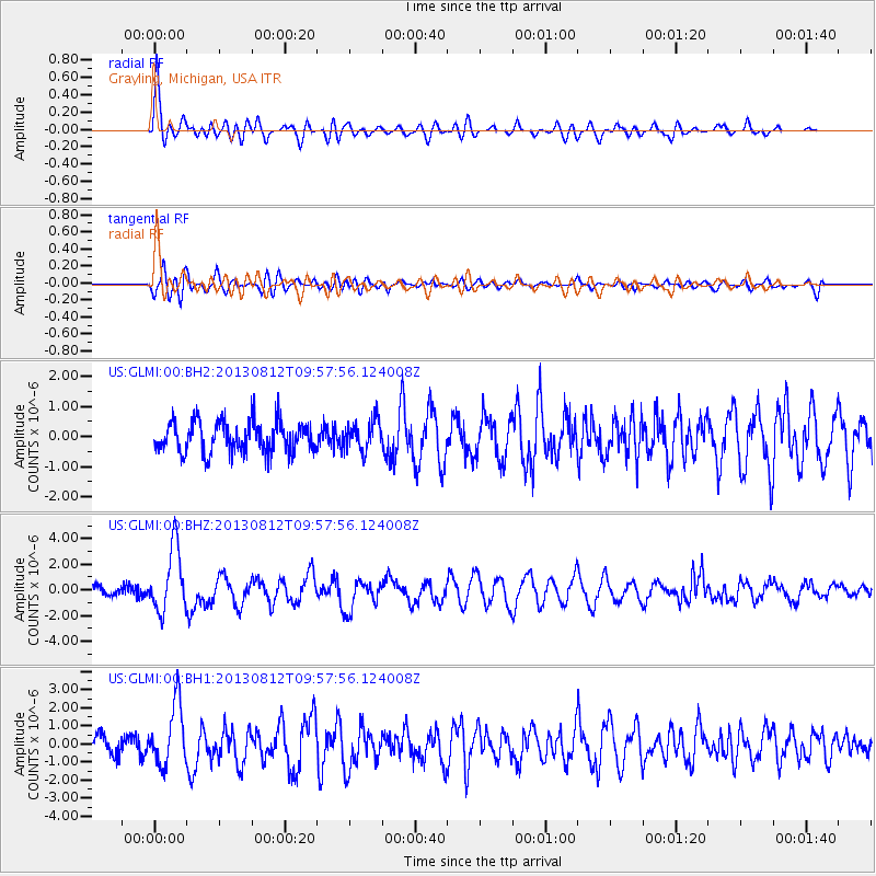
GLMI Grayling, Michigan, USA - Earthquake Result Viewer
*The percent match for this event was below the threshold and hence no stack was calculated.
| Earthquake location: |
Near Coast Of Northern Peru |
| Earthquake latitude/longitude: |
-5.4/-81.9 |
| Earthquake time(UTC): |
2013/08/12 (224) 09:49:32 GMT |
| Earthquake Depth: |
10 km |
| Earthquake Magnitude: |
6.2 MWW, 6.1 MWB, 6.2 MWW, 6.2 MWC, 6.3 MWC |
| Earthquake Catalog/Contributor: |
NEIC PDE/NEIC COMCAT |
|
| Network: |
US United States National Seismic Network |
| Station: |
GLMI Grayling, Michigan, USA |
| Lat/Lon: |
44.82 N/84.62 W |
| Elevation: |
387 m |
|
| Distance: |
50.1 deg |
| Az: |
357.502 deg |
| Baz: |
176.505 deg |
| Ray Param: |
$rayparam |
*The percent match for this event was below the threshold and hence was not used in the summary stack. |
|
| Radial Match: |
79.09619 % |
| Radial Bump: |
400 |
| Transverse Match: |
72.292694 % |
| Transverse Bump: |
400 |
| SOD ConfigId: |
626651 |
| Insert Time: |
2014-04-17 23:39:43.455 +0000 |
| GWidth: |
2.5 |
| Max Bumps: |
400 |
| Tol: |
0.001 |
|
Signal To Noise
| Channel | StoN | STA | LTA |
| US:GLMI:00:BHZ:20130812T09:57:56.124008Z | 6.8456945 | 2.493642E-6 | 3.6426425E-7 |
| US:GLMI:00:BH1:20130812T09:57:56.124008Z | 2.9940536 | 1.7034786E-6 | 5.6895396E-7 |
| US:GLMI:00:BH2:20130812T09:57:56.124008Z | 0.9993889 | 5.07732E-7 | 5.080425E-7 |
| Arrivals |
| Ps | |
| PpPs | |
| PsPs/PpSs | |


