HAWA Hanford, Washington, USA - Earthquake Result Viewer
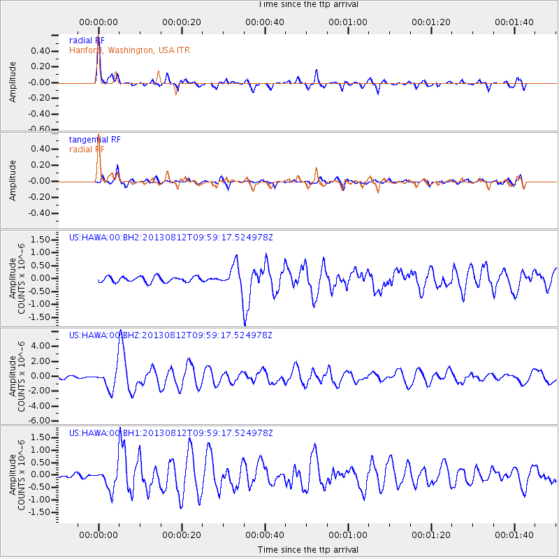
Earthquake location: Near Coast Of Northern Peru
Earthquake latitude/longitude: -5.4/-81.9
Earthquake time(UTC): 2013/08/12 (224) 09:49:32 GMT
Earthquake Depth: 10 km
Earthquake Magnitude: 6.2 MWW, 6.1 MWB, 6.2 MWW, 6.2 MWC, 6.3 MWC
Earthquake Catalog/Contributor: NEIC PDE/NEIC COMCAT
Network: US United States National Seismic Network
Station: HAWA Hanford, Washington, USA
Lat/Lon: 46.39 N/119.53 W
Elevation: 364 m
Distance: 61.4 deg
Az: 331.249 deg
Baz: 136.218 deg
Ray Param: 0.060889583
Estimated Moho Depth: 47.5 km
Estimated Crust Vp/Vs: 1.97
Assumed Crust Vp: 6.419 km/s
Estimated Crust Vs: 3.267 km/s
Estimated Crust Poisson's Ratio: 0.33
Radial Match: 91.78914 %
Radial Bump: 348
Transverse Match: 86.02373 %
Transverse Bump: 400
SOD ConfigId: 626651
Insert Time: 2014-04-17 23:39:48.298 +0000
GWidth: 2.5
Max Bumps: 400
Tol: 0.001

Signal To Noise

ChannelStoNSTALTA
US:HAWA:00:BHZ:20130812T09:59:17.524978Z6.9727971.5091953E-62.1644044E-7
US:HAWA:00:BH1:20130812T09:59:17.524978Z4.64326524.637093E-79.986707E-8
US:HAWA:00:BH2:20130812T09:59:17.524978Z4.5103794.7691213E-71.0573661E-7
Arrivals
Ps7.4 SECOND
PpPs21 SECOND
PsPs/PpSs28 SECOND