LKWY Lake (Yellowstone--Lake), Wyoming, USA - Earthquake Result Viewer
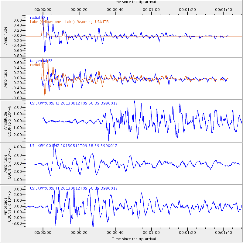
Earthquake location: Near Coast Of Northern Peru
Earthquake latitude/longitude: -5.4/-81.9
Earthquake time(UTC): 2013/08/12 (224) 09:49:32 GMT
Earthquake Depth: 10 km
Earthquake Magnitude: 6.2 MWW, 6.1 MWB, 6.2 MWW, 6.2 MWC, 6.3 MWC
Earthquake Catalog/Contributor: NEIC PDE/NEIC COMCAT
Network: US United States National Seismic Network
Station: LKWY Lake (Yellowstone--Lake), Wyoming, USA
Lat/Lon: 44.57 N/110.40 W
Elevation: 2424 m
Distance: 55.9 deg
Az: 335.706 deg
Baz: 145.037 deg
Ray Param: 0.064475484
Estimated Moho Depth: 28.5 km
Estimated Crust Vp/Vs: 1.60
Assumed Crust Vp: 6.35 km/s
Estimated Crust Vs: 3.969 km/s
Estimated Crust Poisson's Ratio: 0.18
Radial Match: 85.035446 %
Radial Bump: 400
Transverse Match: 85.06398 %
Transverse Bump: 400
SOD ConfigId: 626651
Insert Time: 2014-04-17 23:40:12.243 +0000
GWidth: 2.5
Max Bumps: 400
Tol: 0.001

Signal To Noise

ChannelStoNSTALTA
US:LKWY:00:BHZ:20130812T09:58:39.399001Z8.7556641.1784174E-61.3458916E-7
US:LKWY:00:BH1:20130812T09:58:39.399001Z3.18632225.131769E-71.6105618E-7
US:LKWY:00:BH2:20130812T09:58:39.399001Z3.40127684.783424E-71.4063612E-7
Arrivals
Ps2.8 SECOND
PpPs11 SECOND
PsPs/PpSs14 SECOND