LRAL Lakeview Retreat, Alabama, USA - Earthquake Result Viewer
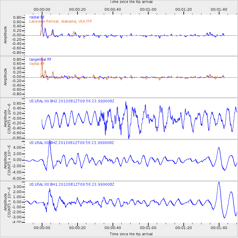
Earthquake location: Near Coast Of Northern Peru
Earthquake latitude/longitude: -5.4/-81.9
Earthquake time(UTC): 2013/08/12 (224) 09:49:32 GMT
Earthquake Depth: 10 km
Earthquake Magnitude: 6.2 MWW, 6.1 MWB, 6.2 MWW, 6.2 MWC, 6.3 MWC
Earthquake Catalog/Contributor: NEIC PDE/NEIC COMCAT
Network: US United States National Seismic Network
Station: LRAL Lakeview Retreat, Alabama, USA
Lat/Lon: 33.03 N/87.00 W
Elevation: 130 m
Distance: 38.5 deg
Az: 353.153 deg
Baz: 171.877 deg
Ray Param: 0.07551358
Estimated Moho Depth: 16.5 km
Estimated Crust Vp/Vs: 1.62
Assumed Crust Vp: 6.565 km/s
Estimated Crust Vs: 4.052 km/s
Estimated Crust Poisson's Ratio: 0.19
Radial Match: 90.43117 %
Radial Bump: 214
Transverse Match: 58.166996 %
Transverse Bump: 400
SOD ConfigId: 626651
Insert Time: 2014-04-17 23:40:16.578 +0000
GWidth: 2.5
Max Bumps: 400
Tol: 0.001

Signal To Noise

ChannelStoNSTALTA
US:LRAL:00:BHZ:20130812T09:56:23.999008Z10.4396032.7343658E-62.619224E-7
US:LRAL:00:BH1:20130812T09:56:23.999008Z6.18422371.1245974E-61.818494E-7
US:LRAL:00:BH2:20130812T09:56:23.999008Z1.06892282.0551612E-71.922647E-7
Arrivals
Ps1.7 SECOND
PpPs6.1 SECOND
PsPs/PpSs7.8 SECOND