MNTX Cornudas Mountains, Texas, USA - Earthquake Result Viewer
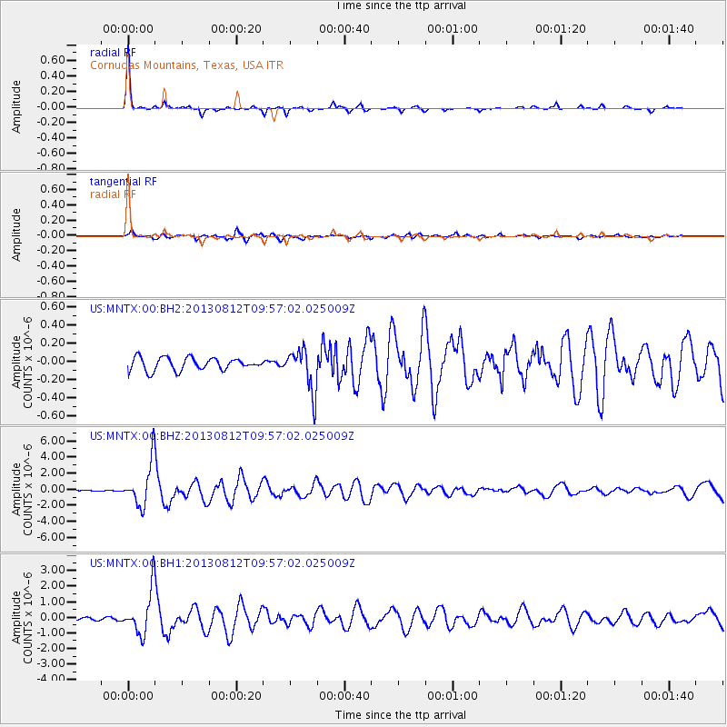
Earthquake location: Near Coast Of Northern Peru
Earthquake latitude/longitude: -5.4/-81.9
Earthquake time(UTC): 2013/08/12 (224) 09:49:32 GMT
Earthquake Depth: 10 km
Earthquake Magnitude: 6.2 MWW, 6.1 MWB, 6.2 MWW, 6.2 MWC, 6.3 MWC
Earthquake Catalog/Contributor: NEIC PDE/NEIC COMCAT
Network: US United States National Seismic Network
Station: MNTX Cornudas Mountains, Texas, USA
Lat/Lon: 31.70 N/105.38 W
Elevation: 404 m
Distance: 43.1 deg
Az: 330.252 deg
Baz: 144.58 deg
Ray Param: 0.07274461
Estimated Moho Depth: 42.25 km
Estimated Crust Vp/Vs: 1.96
Assumed Crust Vp: 6.361 km/s
Estimated Crust Vs: 3.245 km/s
Estimated Crust Poisson's Ratio: 0.32
Radial Match: 94.83775 %
Radial Bump: 235
Transverse Match: 82.97411 %
Transverse Bump: 400
SOD ConfigId: 626651
Insert Time: 2014-04-17 23:40:22.867 +0000
GWidth: 2.5
Max Bumps: 400
Tol: 0.001

Signal To Noise

ChannelStoNSTALTA
US:MNTX:00:BHZ:20130812T09:57:02.025009Z31.1212.7380572E-68.7981014E-8
US:MNTX:00:BH1:20130812T09:57:02.025009Z18.1585241.4289636E-67.869382E-8
US:MNTX:00:BH2:20130812T09:57:02.025009Z3.4678882.40057E-76.922283E-8
Arrivals
Ps6.8 SECOND
PpPs19 SECOND
PsPs/PpSs25 SECOND