NHSC New Hope, South Carolina, USA - Earthquake Result Viewer
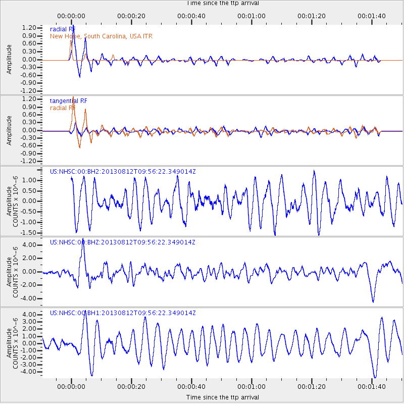
Earthquake location: Near Coast Of Northern Peru
Earthquake latitude/longitude: -5.4/-81.9
Earthquake time(UTC): 2013/08/12 (224) 09:49:32 GMT
Earthquake Depth: 10 km
Earthquake Magnitude: 6.2 MWW, 6.1 MWB, 6.2 MWW, 6.2 MWC, 6.3 MWC
Earthquake Catalog/Contributor: NEIC PDE/NEIC COMCAT
Network: US United States National Seismic Network
Station: NHSC New Hope, South Carolina, USA
Lat/Lon: 33.11 N/80.18 W
Elevation: 11 m
Distance: 38.3 deg
Az: 2.367 deg
Baz: 182.809 deg
Ray Param: 0.07562592
Estimated Moho Depth: 12.5 km
Estimated Crust Vp/Vs: 1.84
Assumed Crust Vp: 6.565 km/s
Estimated Crust Vs: 3.573 km/s
Estimated Crust Poisson's Ratio: 0.29
Radial Match: 87.75939 %
Radial Bump: 336
Transverse Match: 63.3085 %
Transverse Bump: 400
SOD ConfigId: 626651
Insert Time: 2014-04-17 23:40:34.795 +0000
GWidth: 2.5
Max Bumps: 400
Tol: 0.001

Signal To Noise

ChannelStoNSTALTA
US:NHSC:00:BHZ:20130812T09:56:22.349014Z10.3569992.091923E-62.0198159E-7
US:NHSC:00:BH1:20130812T09:56:22.349014Z3.99245551.7935151E-64.4922606E-7
US:NHSC:00:BH2:20130812T09:56:22.349014Z0.60495764.0917774E-76.7637427E-7
Arrivals
Ps1.7 SECOND
PpPs5.0 SECOND
PsPs/PpSs6.7 SECOND