OXF Oxford, Mississippi, USA - Earthquake Result Viewer
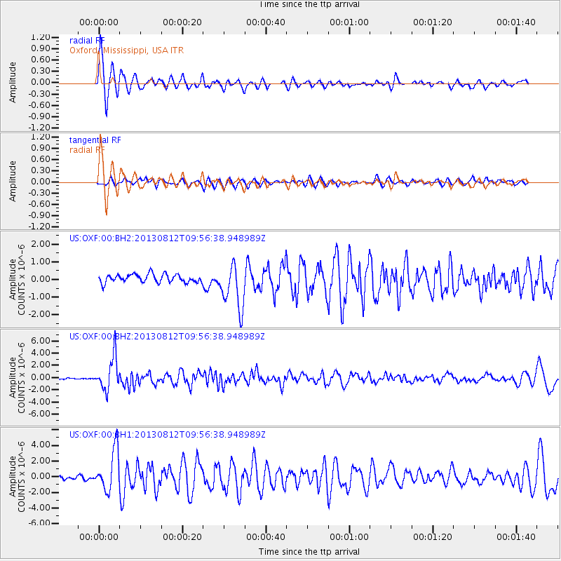
Earthquake location: Near Coast Of Northern Peru
Earthquake latitude/longitude: -5.4/-81.9
Earthquake time(UTC): 2013/08/12 (224) 09:49:32 GMT
Earthquake Depth: 10 km
Earthquake Magnitude: 6.2 MWW, 6.1 MWB, 6.2 MWW, 6.2 MWC, 6.3 MWC
Earthquake Catalog/Contributor: NEIC PDE/NEIC COMCAT
Network: US United States National Seismic Network
Station: OXF Oxford, Mississippi, USA
Lat/Lon: 34.51 N/89.41 W
Elevation: 101 m
Distance: 40.3 deg
Az: 350.433 deg
Baz: 168.44 deg
Ray Param: 0.07446777
Estimated Moho Depth: 10.0 km
Estimated Crust Vp/Vs: 1.60
Assumed Crust Vp: 6.38 km/s
Estimated Crust Vs: 3.988 km/s
Estimated Crust Poisson's Ratio: 0.18
Radial Match: 88.80623 %
Radial Bump: 400
Transverse Match: 69.01937 %
Transverse Bump: 400
SOD ConfigId: 626651
Insert Time: 2014-04-17 23:40:41.592 +0000
GWidth: 2.5
Max Bumps: 400
Tol: 0.001

Signal To Noise

ChannelStoNSTALTA
US:OXF:00:BHZ:20130812T09:56:38.948989Z40.263662.728193E-66.7758194E-8
US:OXF:00:BH1:20130812T09:56:38.948989Z14.2647962.6763241E-61.876174E-7
US:OXF:00:BH2:20130812T09:56:38.948989Z5.66042231.3144099E-62.3221058E-7
Arrivals
Ps1.0 SECOND
PpPs3.8 SECOND
PsPs/PpSs4.8 SECOND