SCIA State Center, Iowa, USA - Earthquake Result Viewer
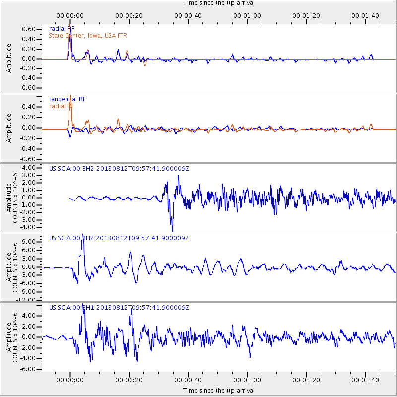
Earthquake location: Near Coast Of Northern Peru
Earthquake latitude/longitude: -5.4/-81.9
Earthquake time(UTC): 2013/08/12 (224) 09:49:32 GMT
Earthquake Depth: 10 km
Earthquake Magnitude: 6.2 MWW, 6.1 MWB, 6.2 MWW, 6.2 MWC, 6.3 MWC
Earthquake Catalog/Contributor: NEIC PDE/NEIC COMCAT
Network: US United States National Seismic Network
Station: SCIA State Center, Iowa, USA
Lat/Lon: 41.91 N/93.22 W
Elevation: 312 m
Distance: 48.2 deg
Az: 348.695 deg
Baz: 164.843 deg
Ray Param: 0.06951735
Estimated Moho Depth: 48.0 km
Estimated Crust Vp/Vs: 1.80
Assumed Crust Vp: 6.498 km/s
Estimated Crust Vs: 3.61 km/s
Estimated Crust Poisson's Ratio: 0.28
Radial Match: 93.26485 %
Radial Bump: 389
Transverse Match: 84.359825 %
Transverse Bump: 400
SOD ConfigId: 626651
Insert Time: 2014-04-17 23:40:48.325 +0000
GWidth: 2.5
Max Bumps: 400
Tol: 0.001

Signal To Noise

ChannelStoNSTALTA
US:SCIA:00:BHZ:20130812T09:57:41.900009Z16.2505744.9266882E-63.031701E-7
US:SCIA:00:BH1:20130812T09:57:41.900009Z5.58982852.4409271E-64.3667302E-7
US:SCIA:00:BH2:20130812T09:57:41.900009Z10.6735171.6361003E-61.5328595E-7
Arrivals
Ps6.3 SECOND
PpPs19 SECOND
PsPs/PpSs26 SECOND