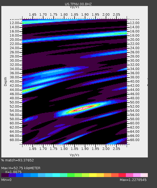
TPNV Topopah Spring, Nevada, USA - Earthquake Result Viewer
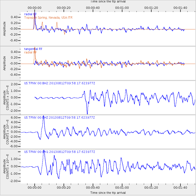
Earthquake location: Near Coast Of Northern Peru
Earthquake latitude/longitude: -5.4/-81.9
Earthquake time(UTC): 2013/08/12 (224) 09:49:32 GMT
Earthquake Depth: 10 km
Earthquake Magnitude: 6.2 MWW, 6.1 MWB, 6.2 MWW, 6.2 MWC, 6.3 MWC
Earthquake Catalog/Contributor: NEIC PDE/NEIC COMCAT
Network: US United States National Seismic Network
Station: TPNV Topopah Spring, Nevada, USA
Lat/Lon: 36.95 N/116.25 W
Elevation: 1600 m
Distance: 52.9 deg
Az: 325.519 deg
Baz: 135.284 deg
Ray Param: 0.06644148
Estimated Moho Depth: 52.75 km
Estimated Crust Vp/Vs: 1.89
Assumed Crust Vp: 6.279 km/s
Estimated Crust Vs: 3.326 km/s
Estimated Crust Poisson's Ratio: 0.30
Radial Match: 93.37652 %
Radial Bump: 400
Transverse Match: 88.478294 %
Transverse Bump: 400
SOD ConfigId: 626651
Insert Time: 2014-04-17 23:40:52.675 +0000
GWidth: 2.5
Max Bumps: 400
Tol: 0.001

Signal To Noise

ChannelStoNSTALTA
US:TPNV:00:BHZ:20130812T09:58:17.623977Z21.6669621.3251702E-66.116087E-8
US:TPNV:00:BH1:20130812T09:58:17.623977Z6.9767214.645748E-76.658928E-8
US:TPNV:00:BH2:20130812T09:58:17.623977Z5.4212133.8780732E-77.1535155E-8
Arrivals
Ps7.8 SECOND
PpPs23 SECOND
PsPs/PpSs31 SECOND