MRBL Marblemount, WA, USA - Earthquake Result Viewer
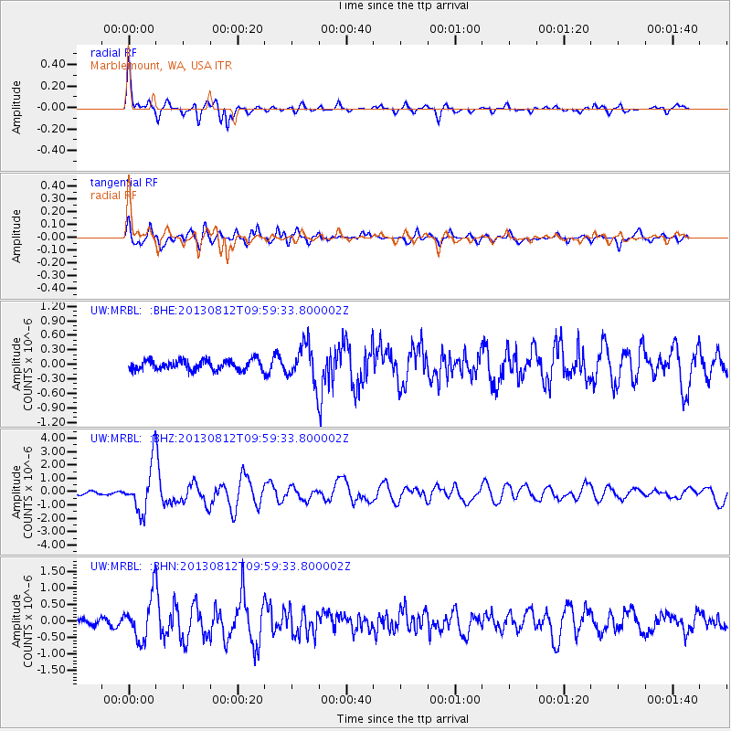
Earthquake location: Near Coast Of Northern Peru
Earthquake latitude/longitude: -5.4/-81.9
Earthquake time(UTC): 2013/08/12 (224) 09:49:32 GMT
Earthquake Depth: 10 km
Earthquake Magnitude: 6.2 MWW, 6.1 MWB, 6.2 MWW, 6.2 MWC, 6.3 MWC
Earthquake Catalog/Contributor: NEIC PDE/NEIC COMCAT
Network: UW Pacific Northwest Regional Seismic Network
Station: MRBL Marblemount, WA, USA
Lat/Lon: 48.52 N/121.48 W
Elevation: 75 m
Distance: 63.9 deg
Az: 331.857 deg
Baz: 135.064 deg
Ray Param: 0.05930208
Estimated Moho Depth: 38.5 km
Estimated Crust Vp/Vs: 1.60
Assumed Crust Vp: 6.566 km/s
Estimated Crust Vs: 4.097 km/s
Estimated Crust Poisson's Ratio: 0.18
Radial Match: 87.26267 %
Radial Bump: 373
Transverse Match: 85.36152 %
Transverse Bump: 400
SOD ConfigId: 626651
Insert Time: 2014-04-17 23:42:52.655 +0000
GWidth: 2.5
Max Bumps: 400
Tol: 0.001

Signal To Noise

ChannelStoNSTALTA
UW:MRBL: :BHZ:20130812T09:59:33.800002Z17.3554021.7968688E-61.0353369E-7
UW:MRBL: :BHN:20130812T09:59:33.800002Z7.5398026.5268415E-78.656516E-8
UW:MRBL: :BHE:20130812T09:59:33.800002Z3.76794053.8868265E-71.031552E-7
Arrivals
Ps3.7 SECOND
PpPs15 SECOND
PsPs/PpSs18 SECOND