You are here: Home > Network List > PF - Volcanologic Network of Piton de Fournaise-OVPF Stations List
> Station HIM cratere Himiltrude > Earthquake Result Viewer
HIM cratere Himiltrude - Earthquake Result Viewer
*The percent match for this event was below the threshold and hence no stack was calculated.
| Earthquake location: |
New Britain Region, P.N.G. |
| Earthquake latitude/longitude: |
-6.0/148.2 |
| Earthquake time(UTC): |
2014/11/07 (311) 03:33:54 GMT |
| Earthquake Depth: |
43 km |
| Earthquake Magnitude: |
6.6 MWW, 6.6 MWB, 6.9 MI |
| Earthquake Catalog/Contributor: |
NEIC PDE/NEIC COMCAT |
|
| Network: |
PF Volcanologic Network of Piton de Fournaise-OVPF |
| Station: |
HIM cratere Himiltrude |
| Lat/Lon: |
21.21 S/55.72 E |
| Elevation: |
1958 m |
|
| Distance: |
90.2 deg |
| Az: |
248.779 deg |
| Baz: |
96.496 deg |
| Ray Param: |
$rayparam |
*The percent match for this event was below the threshold and hence was not used in the summary stack. |
|
| Radial Match: |
41.914505 % |
| Radial Bump: |
400 |
| Transverse Match: |
53.48559 % |
| Transverse Bump: |
400 |
| SOD ConfigId: |
3390531 |
| Insert Time: |
2019-04-14 21:07:21.199 +0000 |
| GWidth: |
2.5 |
| Max Bumps: |
400 |
| Tol: |
0.001 |
|
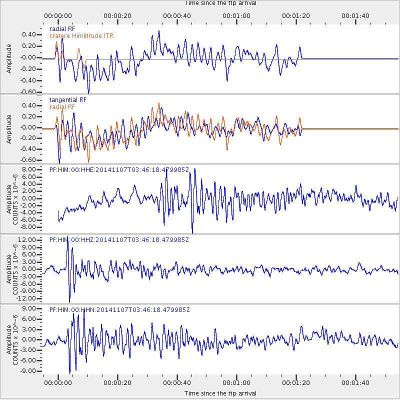
Signal To Noise
| Channel | StoN | STA | LTA |
| PF:HIM:00:HHZ:20141107T03:46:18.479985Z | 7.5607266 | 5.206025E-6 | 6.8856144E-7 |
| PF:HIM:00:HHN:20141107T03:46:18.479985Z | 1.5445087 | 3.032123E-6 | 1.9631634E-6 |
| PF:HIM:00:HHE:20141107T03:46:18.479985Z | 1.1474096 | 2.1895464E-6 | 1.908252E-6 |
| Arrivals |
| Ps | |
| PpPs | |
| PsPs/PpSs | |


