
MVL Millersville University, PA - Earthquake Result Viewer
| ||||||||||||||||||
| ||||||||||||||||||
| ||||||||||||||||||
|
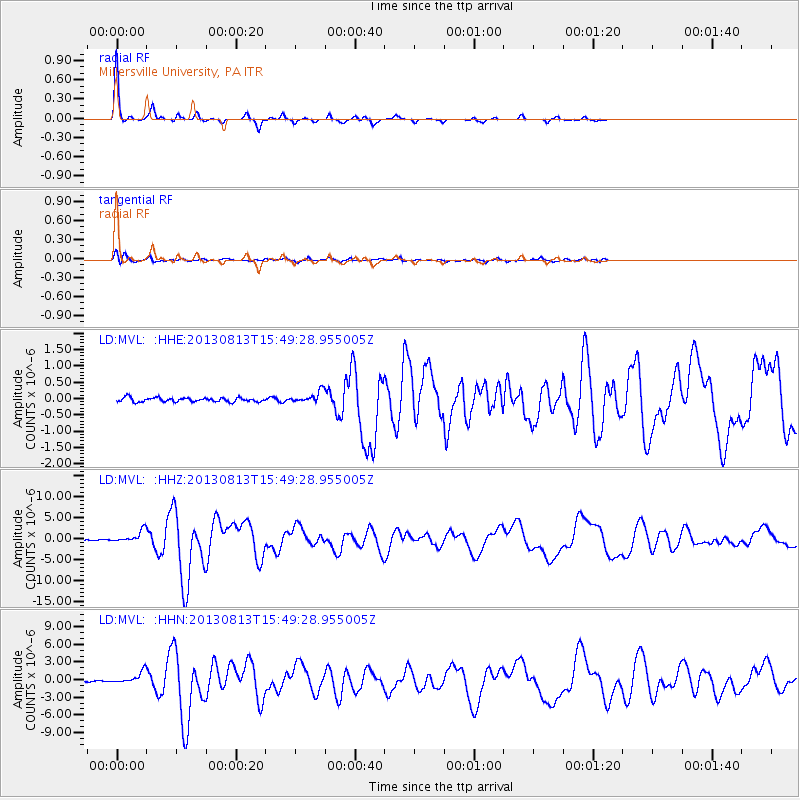
Signal To Noise
| Channel | StoN | STA | LTA |
| LD:MVL: :HHZ:20130813T15:49:28.955005Z | 12.082687 | 1.362602E-6 | 1.12773094E-7 |
| LD:MVL: :HHN:20130813T15:49:28.955005Z | 6.5616965 | 9.741032E-7 | 1.4845294E-7 |
| LD:MVL: :HHE:20130813T15:49:28.955005Z | 2.7368493 | 1.692079E-7 | 6.18258E-8 |
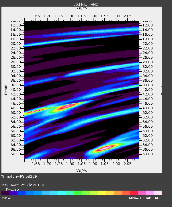
| Arrivals | |
| Ps | 10 SECOND |
| PpPs | 28 SECOND |
| PsPs/PpSs | 38 SECOND |

