
WRPS We R Penn State - Earthquake Result Viewer
| ||||||||||||||||||
| ||||||||||||||||||
| ||||||||||||||||||
|
Signal To Noise
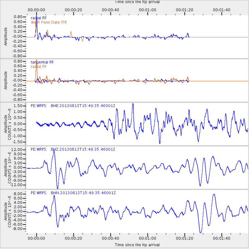
| Channel | StoN | STA | LTA |
| PE:WRPS: :BHZ:20130813T15:49:35.46001Z | 17.298178 | 1.902708E-6 | 1.0999471E-7 |
| PE:WRPS: :BHN:20130813T15:49:35.46001Z | 12.67993 | 1.0507745E-6 | 8.28691E-8 |
| PE:WRPS: :BHE:20130813T15:49:35.46001Z | 1.4101514 | 1.3808146E-7 | 9.791961E-8 |
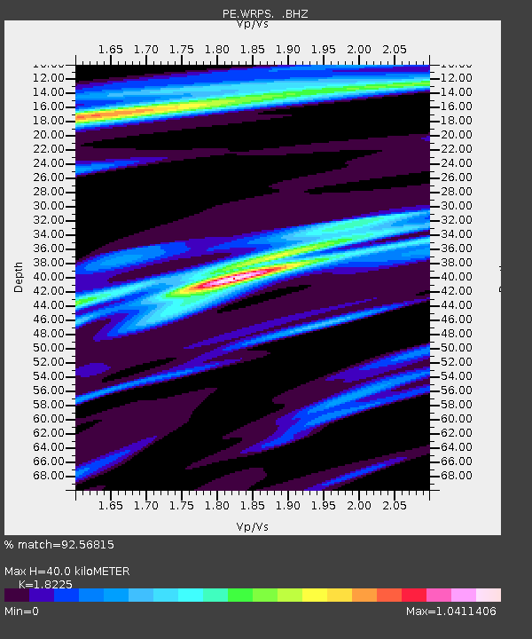
| Arrivals | |
| Ps | 5.7 SECOND |
| PpPs | 17 SECOND |
| PsPs/PpSs | 23 SECOND |

