You are here: Home > Network List > AV - Alaska Volcano Observatory Stations List
> Station SPCR Ckakachatna River, Mount Spurr, Alaska > Earthquake Result Viewer
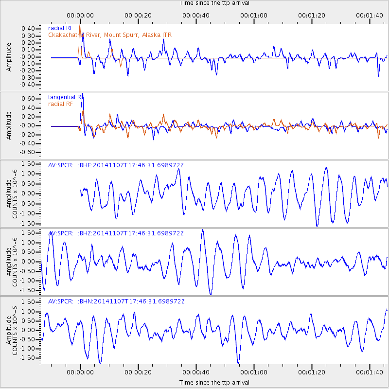
SPCR Ckakachatna River, Mount Spurr, Alaska - Earthquake Result Viewer
*The percent match for this event was below the threshold and hence no stack was calculated.
| Earthquake location: |
New Britain Region, P.N.G. |
| Earthquake latitude/longitude: |
-6.4/148.6 |
| Earthquake time(UTC): |
2014/11/07 (311) 17:34:49 GMT |
| Earthquake Depth: |
35 km |
| Earthquake Magnitude: |
5.3 MW, 5.1 mb, 4.6 MS |
| Earthquake Catalog/Contributor: |
ISC/ISC |
|
| Network: |
AV Alaska Volcano Observatory |
| Station: |
SPCR Ckakachatna River, Mount Spurr, Alaska |
| Lat/Lon: |
61.20 N/152.21 W |
| Elevation: |
984 m |
|
| Distance: |
81.4 deg |
| Az: |
24.867 deg |
| Baz: |
239.663 deg |
| Ray Param: |
$rayparam |
*The percent match for this event was below the threshold and hence was not used in the summary stack. |
|
| Radial Match: |
61.76648 % |
| Radial Bump: |
400 |
| Transverse Match: |
71.699684 % |
| Transverse Bump: |
400 |
| SOD ConfigId: |
3390531 |
| Insert Time: |
2019-04-14 21:15:07.707 +0000 |
| GWidth: |
2.5 |
| Max Bumps: |
400 |
| Tol: |
0.001 |
|
Signal To Noise
| Channel | StoN | STA | LTA |
| AV:SPCR: :BHZ:20141107T17:46:31.698972Z | 0.46758634 | 3.9128483E-7 | 8.3681834E-7 |
| AV:SPCR: :BHN:20141107T17:46:31.698972Z | 1.4151597 | 8.10328E-7 | 5.7260536E-7 |
| AV:SPCR: :BHE:20141107T17:46:31.698972Z | 1.6975411 | 7.990405E-7 | 4.7070466E-7 |
| Arrivals |
| Ps | |
| PpPs | |
| PsPs/PpSs | |


