PEMO PEMBROKE, ON - Earthquake Result Viewer
Earthquake location: South Of Panama
Earthquake latitude/longitude: 5.8/-78.2
Earthquake time(UTC): 2013/08/13 (225) 15:43:15 GMT
Earthquake Depth: 12 km
Earthquake Magnitude: 6.7 MWW, 6.6 MWB, 6.7 MWW, 6.7 MWC, 6.7 MI
Earthquake Catalog/Contributor: NEIC PDE/NEIC COMCAT
Network: PO Portable Observatories for Lithospheric Analysis and Research Investigating Seis
Station: PEMO PEMBROKE, ON
Lat/Lon: 45.68 N/77.25 W
Elevation: 180 m
Distance: 39.8 deg
Az: 1.045 deg
Baz: 181.483 deg
Ray Param: 0.07479311
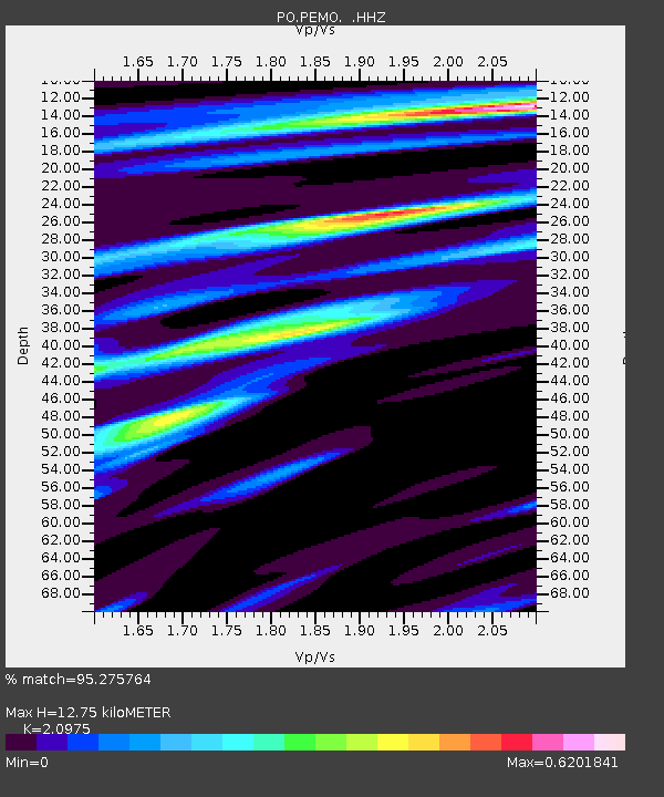
Estimated Moho Depth: 12.75 km
Estimated Crust Vp/Vs: 2.10
Assumed Crust Vp: 6.577 km/s
Estimated Crust Vs: 3.136 km/s
Estimated Crust Poisson's Ratio: 0.35
Radial Match: 95.275764 %
Radial Bump: 182
Transverse Match: 59.625637 %
Transverse Bump: 400
SOD ConfigId: 626651
Insert Time: 2014-04-18 00:20:08.266 +0000
GWidth: 2.5
Max Bumps: 400
Tol: 0.001

Signal To Noise

ChannelStoNSTALTA
PO:PEMO: :HHZ:20130813T15:50:16.849994Z5.58515558.523491E-71.5260973E-7
PO:PEMO: :HHN:20130813T15:50:16.849994Z3.62816174.6252566E-71.274821E-7
PO:PEMO: :HHE:20130813T15:50:16.849994Z1.27816681.2708249E-79.942559E-8
Arrivals
Ps2.3 SECOND
PpPs5.6 SECOND
PsPs/PpSs7.9 SECOND