You are here: Home > Network List > TA - USArray Transportable Network (new EarthScope stations) Stations List
> Station N47A Urbana, IN, USA > Earthquake Result Viewer
N47A Urbana, IN, USA - Earthquake Result Viewer

| Earthquake location: |
South Of Panama |
| Earthquake latitude/longitude: |
5.8/-78.2 |
| Earthquake time(UTC): |
2013/08/13 (225) 15:43:15 GMT |
| Earthquake Depth: |
12 km |
| Earthquake Magnitude: |
6.7 MWW, 6.6 MWB, 6.7 MWW, 6.7 MWC, 6.7 MI |
| Earthquake Catalog/Contributor: |
NEIC PDE/NEIC COMCAT |
|
| Network: |
TA USArray Transportable Network (new EarthScope stations) |
| Station: |
N47A Urbana, IN, USA |
| Lat/Lon: |
40.88 N/85.69 W |
| Elevation: |
252 m |
|
| Distance: |
35.6 deg |
| Az: |
350.217 deg |
| Baz: |
167.117 deg |
| Ray Param: |
0.07713436 |
| Estimated Moho Depth: |
32.5 km |
| Estimated Crust Vp/Vs: |
1.85 |
| Assumed Crust Vp: |
6.498 km/s |
| Estimated Crust Vs: |
3.522 km/s |
| Estimated Crust Poisson's Ratio: |
0.29 |
|
| Radial Match: |
92.2962 % |
| Radial Bump: |
277 |
| Transverse Match: |
74.65807 % |
| Transverse Bump: |
400 |
| SOD ConfigId: |
626651 |
| Insert Time: |
2014-04-18 00:29:48.565 +0000 |
| GWidth: |
2.5 |
| Max Bumps: |
400 |
| Tol: |
0.001 |
|
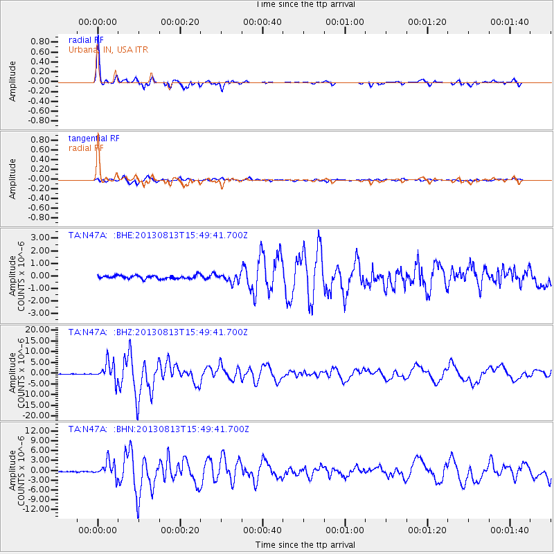
Signal To Noise
| Channel | StoN | STA | LTA |
| TA:N47A: :BHZ:20130813T15:49:41.700Z | 26.091085 | 4.487343E-6 | 1.719876E-7 |
| TA:N47A: :BHN:20130813T15:49:41.700Z | 13.917601 | 2.498855E-6 | 1.7954639E-7 |
| TA:N47A: :BHE:20130813T15:49:41.700Z | 2.3920126 | 3.2342246E-7 | 1.3520935E-7 |
| Arrivals |
| Ps | 4.6 SECOND |
| PpPs | 13 SECOND |
| PsPs/PpSs | 18 SECOND |


