You are here: Home > Network List > TA - USArray Transportable Network (new EarthScope stations) Stations List
> Station O56A Blue Knob State Park, Imler, PA, USA > Earthquake Result Viewer
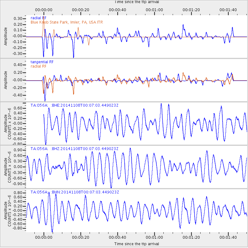
O56A Blue Knob State Park, Imler, PA, USA - Earthquake Result Viewer
*The percent match for this event was below the threshold and hence no stack was calculated.
| Earthquake location: |
Off East Coast Of Honshu, Japan |
| Earthquake latitude/longitude: |
37.8/142.4 |
| Earthquake time(UTC): |
2014/11/07 (311) 23:54:21 GMT |
| Earthquake Depth: |
35 km |
| Earthquake Magnitude: |
5.1 MW, 5.3 mb, 4.5 MS |
| Earthquake Catalog/Contributor: |
ISC/ISC |
|
| Network: |
TA USArray Transportable Network (new EarthScope stations) |
| Station: |
O56A Blue Knob State Park, Imler, PA, USA |
| Lat/Lon: |
40.27 N/78.57 W |
| Elevation: |
684 m |
|
| Distance: |
93.7 deg |
| Az: |
30.157 deg |
| Baz: |
328.671 deg |
| Ray Param: |
$rayparam |
*The percent match for this event was below the threshold and hence was not used in the summary stack. |
|
| Radial Match: |
51.591118 % |
| Radial Bump: |
400 |
| Transverse Match: |
58.11416 % |
| Transverse Bump: |
400 |
| SOD ConfigId: |
3390531 |
| Insert Time: |
2019-04-14 21:30:03.340 +0000 |
| GWidth: |
2.5 |
| Max Bumps: |
400 |
| Tol: |
0.001 |
|
Signal To Noise
| Channel | StoN | STA | LTA |
| TA:O56A: :BHZ:20141108T00:07:03.449023Z | 0.79951906 | 4.366628E-7 | 5.461568E-7 |
| TA:O56A: :BHN:20141108T00:07:03.449023Z | 1.9380639 | 5.6530484E-7 | 2.9168535E-7 |
| TA:O56A: :BHE:20141108T00:07:03.449023Z | 0.8516619 | 2.8960682E-7 | 3.4004904E-7 |
| Arrivals |
| Ps | |
| PpPs | |
| PsPs/PpSs | |


