You are here: Home > Network List > US - United States National Seismic Network Stations List
> Station AMTX Amarillo, Texas, USA > Earthquake Result Viewer
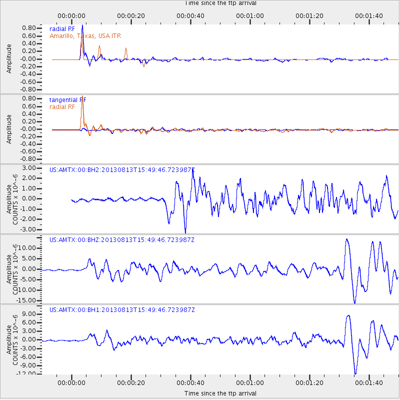
AMTX Amarillo, Texas, USA - Earthquake Result Viewer
*The percent match for this event was below the threshold and hence no stack was calculated.
| Earthquake location: |
South Of Panama |
| Earthquake latitude/longitude: |
5.8/-78.2 |
| Earthquake time(UTC): |
2013/08/13 (225) 15:43:15 GMT |
| Earthquake Depth: |
12 km |
| Earthquake Magnitude: |
6.7 MWW, 6.6 MWB, 6.7 MWW, 6.7 MWC, 6.7 MI |
| Earthquake Catalog/Contributor: |
NEIC PDE/NEIC COMCAT |
|
| Network: |
US United States National Seismic Network |
| Station: |
AMTX Amarillo, Texas, USA |
| Lat/Lon: |
34.53 N/101.41 W |
| Elevation: |
1010 m |
|
| Distance: |
35.8 deg |
| Az: |
326.179 deg |
| Baz: |
137.87 deg |
| Ray Param: |
$rayparam |
*The percent match for this event was below the threshold and hence was not used in the summary stack. |
|
| Radial Match: |
94.29077 % |
| Radial Bump: |
287 |
| Transverse Match: |
70.422195 % |
| Transverse Bump: |
400 |
| SOD ConfigId: |
626651 |
| Insert Time: |
2014-04-18 00:37:24.306 +0000 |
| GWidth: |
2.5 |
| Max Bumps: |
400 |
| Tol: |
0.001 |
|
Signal To Noise
| Channel | StoN | STA | LTA |
| US:AMTX:00:BHZ:20130813T15:49:46.723987Z | 2.7901785 | 3.5295278E-7 | 1.2649828E-7 |
| US:AMTX:00:BH1:20130813T15:49:46.723987Z | 1.4845084 | 1.5984668E-7 | 1.07676506E-7 |
| US:AMTX:00:BH2:20130813T15:49:46.723987Z | 1.0305223 | 1.0937495E-7 | 1.0613546E-7 |
| Arrivals |
| Ps | |
| PpPs | |
| PsPs/PpSs | |


