
SNAA GEOFON/AWI Station Sanae, Antarctica - Earthquake Result Viewer
| ||||||||||||||||||
| ||||||||||||||||||
| ||||||||||||||||||
|
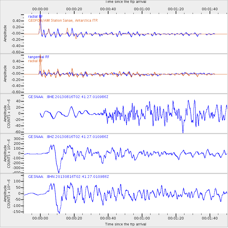
Signal To Noise
| Channel | StoN | STA | LTA |
| GE:SNAA: :BHZ:20130816T02:41:27.010986Z | 2.1653023 | 1.3843367E-5 | 6.393272E-6 |
| GE:SNAA: :BHN:20130816T02:41:27.010986Z | 2.1464252 | 1.2564608E-5 | 5.853737E-6 |
| GE:SNAA: :BHE:20130816T02:41:27.010986Z | 0.2315302 | 2.0145662E-6 | 8.701095E-6 |
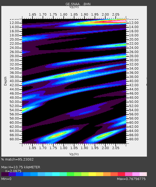
| Arrivals | |
| Ps | 1.9 SECOND |
| PpPs | 5.0 SECOND |
| PsPs/PpSs | 6.9 SECOND |

