You are here: Home > Network List > G - GEOSCOPE Stations List
> Station TAOE Taiohae, Marquises islands > Earthquake Result Viewer
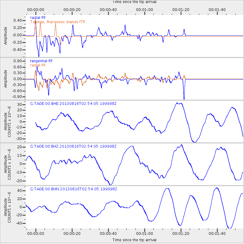
TAOE Taiohae, Marquises islands - Earthquake Result Viewer
*The percent match for this event was below the threshold and hence no stack was calculated.
| Earthquake location: |
Cook Strait, New Zealand |
| Earthquake latitude/longitude: |
-41.8/174.1 |
| Earthquake time(UTC): |
2013/08/16 (228) 02:45:27 GMT |
| Earthquake Depth: |
5.8 km |
| Earthquake Magnitude: |
5.6 MW, 5.5 MWR, 5.6 MWC |
| Earthquake Catalog/Contributor: |
NEIC PDE/NEIC COMCAT |
|
| Network: |
G GEOSCOPE |
| Station: |
TAOE Taiohae, Marquises islands |
| Lat/Lon: |
8.85 S/140.15 W |
| Elevation: |
800 m |
|
| Distance: |
51.9 deg |
| Az: |
64.122 deg |
| Baz: |
222.93 deg |
| Ray Param: |
$rayparam |
*The percent match for this event was below the threshold and hence was not used in the summary stack. |
|
| Radial Match: |
79.2813 % |
| Radial Bump: |
400 |
| Transverse Match: |
49.3297 % |
| Transverse Bump: |
400 |
| SOD ConfigId: |
626651 |
| Insert Time: |
2014-04-18 00:56:38.883 +0000 |
| GWidth: |
2.5 |
| Max Bumps: |
400 |
| Tol: |
0.001 |
|
Signal To Noise
| Channel | StoN | STA | LTA |
| G:TAOE:00:BHZ:20130816T02:54:05.199998Z | 4.173054 | 1.1527833E-5 | 2.762445E-6 |
| G:TAOE:00:BHN:20130816T02:54:05.199998Z | 0.5268908 | 3.6401566E-6 | 6.908749E-6 |
| G:TAOE:00:BHE:20130816T02:54:05.199998Z | 1.0298084 | 1.00531915E-5 | 9.762197E-6 |
| Arrivals |
| Ps | |
| PpPs | |
| PsPs/PpSs | |


