You are here: Home > Network List > IU - Global Seismograph Network (GSN - IRIS/USGS) Stations List
> Station HNR Honiara, Solomon Islands > Earthquake Result Viewer
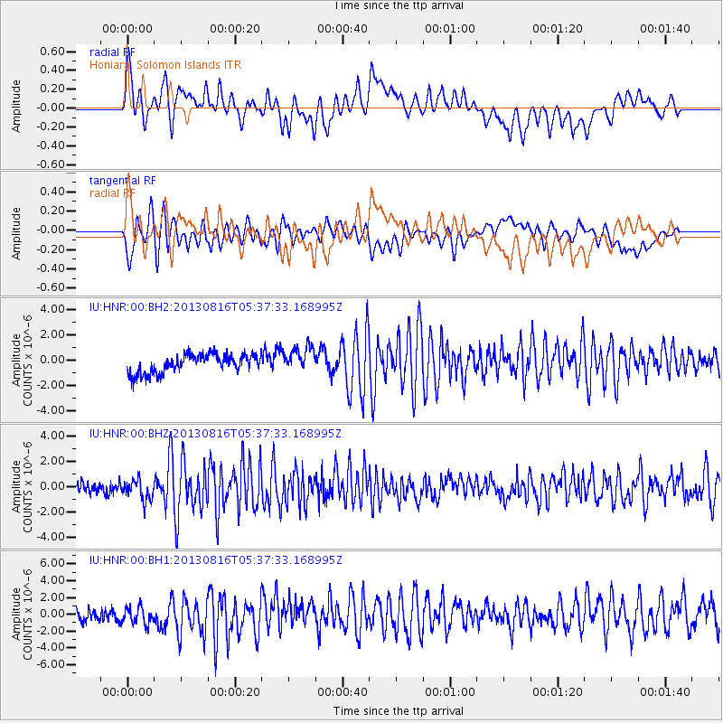
HNR Honiara, Solomon Islands - Earthquake Result Viewer
*The percent match for this event was below the threshold and hence no stack was calculated.
| Earthquake location: |
Cook Strait, New Zealand |
| Earthquake latitude/longitude: |
-41.7/174.3 |
| Earthquake time(UTC): |
2013/08/16 (228) 05:31:16 GMT |
| Earthquake Depth: |
14 km |
| Earthquake Magnitude: |
5.8 MW, 5.8 MWR, 5.9 MWC, 5.9 MWW, 5.9 MWW |
| Earthquake Catalog/Contributor: |
NEIC PDE/NEIC COMCAT |
|
| Network: |
IU Global Seismograph Network (GSN - IRIS/USGS) |
| Station: |
HNR Honiara, Solomon Islands |
| Lat/Lon: |
9.44 S/159.95 E |
| Elevation: |
100 m |
|
| Distance: |
34.5 deg |
| Az: |
334.486 deg |
| Baz: |
160.908 deg |
| Ray Param: |
$rayparam |
*The percent match for this event was below the threshold and hence was not used in the summary stack. |
|
| Radial Match: |
61.437534 % |
| Radial Bump: |
400 |
| Transverse Match: |
68.10516 % |
| Transverse Bump: |
400 |
| SOD ConfigId: |
626651 |
| Insert Time: |
2014-04-18 01:14:33.865 +0000 |
| GWidth: |
2.5 |
| Max Bumps: |
400 |
| Tol: |
0.001 |
|
Signal To Noise
| Channel | StoN | STA | LTA |
| IU:HNR:00:BHZ:20130816T05:37:33.168995Z | 1.9217454 | 7.8991303E-7 | 4.110394E-7 |
| IU:HNR:00:BH1:20130816T05:37:33.168995Z | 1.1935581 | 1.1192822E-6 | 9.3776936E-7 |
| IU:HNR:00:BH2:20130816T05:37:33.168995Z | 1.3232892 | 9.717327E-7 | 7.343313E-7 |
| Arrivals |
| Ps | |
| PpPs | |
| PsPs/PpSs | |


