You are here: Home > Network List > IU - Global Seismograph Network (GSN - IRIS/USGS) Stations List
> Station GNI Garni, Armenia > Earthquake Result Viewer
GNI Garni, Armenia - Earthquake Result Viewer
| Earthquake location: |
Southwest Indian Ridge |
| Earthquake latitude/longitude: |
-34.9/54.1 |
| Earthquake time(UTC): |
2013/08/17 (229) 16:32:31 GMT |
| Earthquake Depth: |
10 km |
| Earthquake Magnitude: |
6.1 MWW, 6.1 MWB, 6.2 MWW, 6.2 MWC |
| Earthquake Catalog/Contributor: |
NEIC PDE/NEIC COMCAT |
|
| Network: |
IU Global Seismograph Network (GSN - IRIS/USGS) |
| Station: |
GNI Garni, Armenia |
| Lat/Lon: |
40.15 N/44.74 E |
| Elevation: |
1609 m |
|
| Distance: |
75.2 deg |
| Az: |
352.597 deg |
| Baz: |
172.057 deg |
| Ray Param: |
0.05185324 |
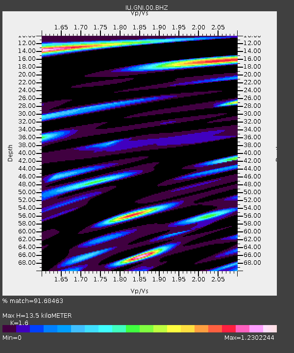
| Estimated Moho Depth: |
13.5 km |
| Estimated Crust Vp/Vs: |
1.60 |
| Assumed Crust Vp: |
6.291 km/s |
| Estimated Crust Vs: |
3.932 km/s |
| Estimated Crust Poisson's Ratio: |
0.18 |
|
| Radial Match: |
91.68463 % |
| Radial Bump: |
400 |
| Transverse Match: |
89.75763 % |
| Transverse Bump: |
400 |
| SOD ConfigId: |
626651 |
| Insert Time: |
2014-04-18 01:23:13.655 +0000 |
| GWidth: |
2.5 |
| Max Bumps: |
400 |
| Tol: |
0.001 |
|
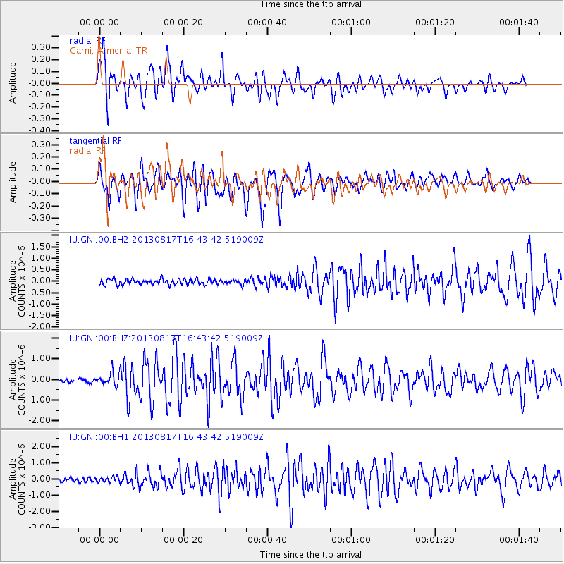
Signal To Noise
| Channel | StoN | STA | LTA |
| IU:GNI:00:BHZ:20130817T16:43:42.519009Z | 4.1205993 | 3.2177235E-7 | 7.8088725E-8 |
| IU:GNI:00:BH1:20130817T16:43:42.519009Z | 1.3736228 | 1.4390334E-7 | 1.047619E-7 |
| IU:GNI:00:BH2:20130817T16:43:42.519009Z | 0.8045813 | 9.057875E-8 | 1.12578746E-7 |
| Arrivals |
| Ps | 1.3 SECOND |
| PpPs | 5.4 SECOND |
| PsPs/PpSs | 6.7 SECOND |


