You are here: Home > Network List > TA - USArray Transportable Network (new EarthScope stations) Stations List
> Station 121A Cookes Peak, Deming, NM, USA > Earthquake Result Viewer
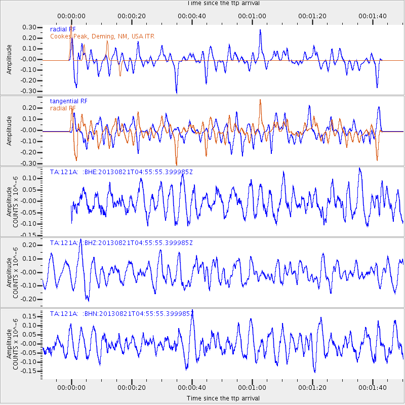
121A Cookes Peak, Deming, NM, USA - Earthquake Result Viewer
*The percent match for this event was below the threshold and hence no stack was calculated.
| Earthquake location: |
Southeast Of Loyalty Islands |
| Earthquake latitude/longitude: |
-22.3/171.7 |
| Earthquake time(UTC): |
2013/08/21 (233) 04:43:18 GMT |
| Earthquake Depth: |
92 km |
| Earthquake Magnitude: |
5.7 MWW, 5.7 MWB, 5.7 MWC |
| Earthquake Catalog/Contributor: |
NEIC PDE/NEIC COMCAT |
|
| Network: |
TA USArray Transportable Network (new EarthScope stations) |
| Station: |
121A Cookes Peak, Deming, NM, USA |
| Lat/Lon: |
32.53 N/107.79 W |
| Elevation: |
1652 m |
|
| Distance: |
94.2 deg |
| Az: |
56.668 deg |
| Baz: |
246.349 deg |
| Ray Param: |
$rayparam |
*The percent match for this event was below the threshold and hence was not used in the summary stack. |
|
| Radial Match: |
61.45769 % |
| Radial Bump: |
400 |
| Transverse Match: |
53.936447 % |
| Transverse Bump: |
400 |
| SOD ConfigId: |
626651 |
| Insert Time: |
2014-04-18 01:41:08.962 +0000 |
| GWidth: |
2.5 |
| Max Bumps: |
400 |
| Tol: |
0.001 |
|
Signal To Noise
| Channel | StoN | STA | LTA |
| TA:121A: :BHZ:20130821T04:55:55.399985Z | 2.4795518 | 1.2166836E-7 | 4.906869E-8 |
| TA:121A: :BHN:20130821T04:55:55.399985Z | 1.0834502 | 6.077744E-8 | 5.6096194E-8 |
| TA:121A: :BHE:20130821T04:55:55.399985Z | 1.5530846 | 5.8737793E-8 | 3.7820087E-8 |
| Arrivals |
| Ps | |
| PpPs | |
| PsPs/PpSs | |


