You are here: Home > Network List > US - United States National Seismic Network Stations List
> Station HAWA Hanford, Washington, USA > Earthquake Result Viewer
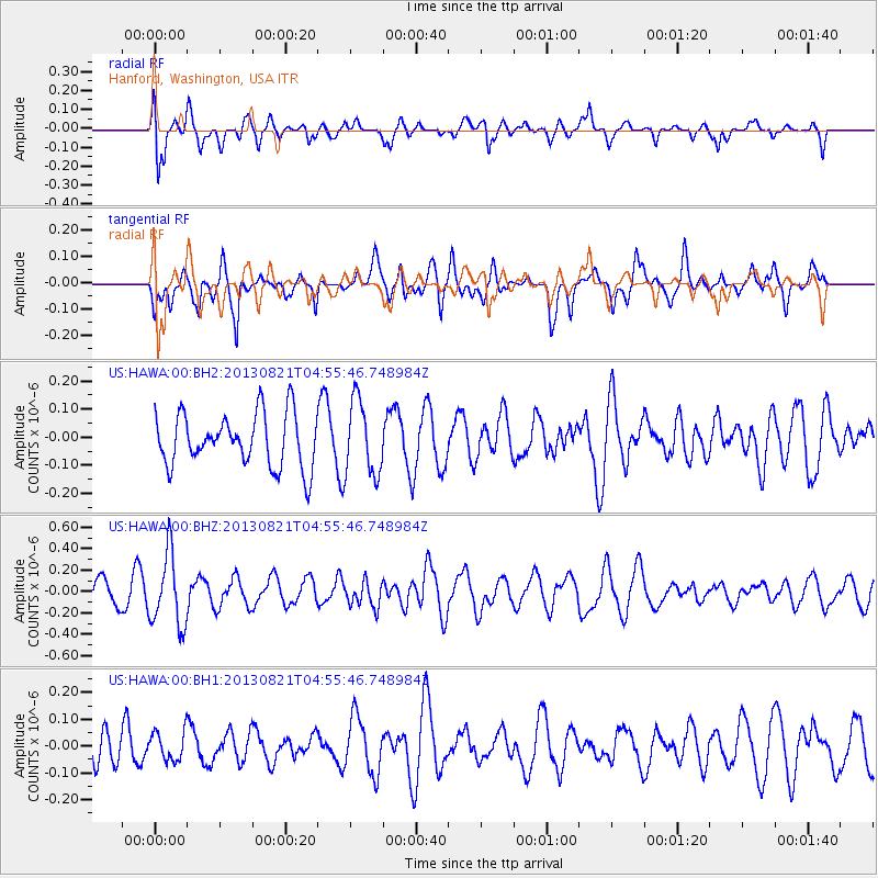
HAWA Hanford, Washington, USA - Earthquake Result Viewer
*The percent match for this event was below the threshold and hence no stack was calculated.
| Earthquake location: |
Southeast Of Loyalty Islands |
| Earthquake latitude/longitude: |
-22.3/171.7 |
| Earthquake time(UTC): |
2013/08/21 (233) 04:43:18 GMT |
| Earthquake Depth: |
92 km |
| Earthquake Magnitude: |
5.7 MWW, 5.7 MWB, 5.7 MWC |
| Earthquake Catalog/Contributor: |
NEIC PDE/NEIC COMCAT |
|
| Network: |
US United States National Seismic Network |
| Station: |
HAWA Hanford, Washington, USA |
| Lat/Lon: |
46.39 N/119.53 W |
| Elevation: |
364 m |
|
| Distance: |
92.3 deg |
| Az: |
40.227 deg |
| Baz: |
239.784 deg |
| Ray Param: |
$rayparam |
*The percent match for this event was below the threshold and hence was not used in the summary stack. |
|
| Radial Match: |
58.06277 % |
| Radial Bump: |
400 |
| Transverse Match: |
63.098656 % |
| Transverse Bump: |
400 |
| SOD ConfigId: |
626651 |
| Insert Time: |
2014-04-18 01:42:40.173 +0000 |
| GWidth: |
2.5 |
| Max Bumps: |
400 |
| Tol: |
0.001 |
|
Signal To Noise
| Channel | StoN | STA | LTA |
| US:HAWA:00:BHZ:20130821T04:55:46.748984Z | 2.7826457 | 3.3756982E-7 | 1.2131254E-7 |
| US:HAWA:00:BH1:20130821T04:55:46.748984Z | 0.832763 | 5.333515E-8 | 6.404601E-8 |
| US:HAWA:00:BH2:20130821T04:55:46.748984Z | 1.4177046 | 1.3232265E-7 | 9.333584E-8 |
| Arrivals |
| Ps | |
| PpPs | |
| PsPs/PpSs | |


